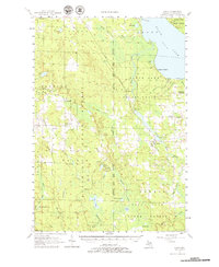
1957 Map of Tower
USGS Topo · Published 1979About this map
Tower and the surrounding Cheboygan County timberlands are defined by a network of state forests and the winding course of the Black River. This mid-century survey captures a landscape of transition where small settlements like Afton and Legrand are connected by the Detroit and Mackinac rail line and Adair Road. The presence of several defunct institutions, such as School No 2 and School No 1, alongside the Waverly Cem and the Free Ch, provides a clear view of the shifting rural population during the 1950s.
Find a feature on this map
88 named features on this map. Tap any name to fly to it.
Don’t see what you’re looking for? This feature index may not catch every label — zoom into the map to look around manually.
Map Details
Editions of this 1957 Tower Map
3 editions found

Other maps of this area

1954 · Gaylord
USGS Topo · 1:62,500

1954 · Hetherton
USGS Topo · 1:62,500

1955 · Atlanta
USGS Topo · 1:62,500

1955 · Cheboygan
USGS Topo · 1:250,000

1957 · Tower
USGS Topo · 1:62,500

1957 · Wolverine
USGS Topo · 1:62,500

1957 · Cheboygan
USGS Topo · 1:62,500

1957 · Mullett Lake
USGS Topo · 1:62,500

1957 · Onaway
USGS Topo · 1:62,500

1958 · Cheboygan
USGS Topo · 1:250,000