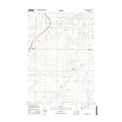
2017 Map of Green Timbers
USGS Topo · Published 2017About this map
The Sturgeon River flows northward through this portion of Northern Michigan, defining a landscape of dense water networks and forest tracks. The settlement of Green Timbers lies at the heart of the region, where the Green Timbers Trail meets the river. To the north, the small community of Trowbridge sits near the N Central State Trail, a route that mirrors the historic rail corridors of Cheboygan County. The terrain is marked by numerous glacial features, including Storey Lake, Pickerel Lake, and Mud Lake.
Find a feature on this map
82 named features on this map. Tap any name to fly to it.
Don’t see what you’re looking for? This feature index may not catch every label — zoom into the map to look around manually.
Map Details
Editions of this 2017 Green Timbers Map
This is the sole edition of this map. No revisions or reprints were ever made.
Other maps of this area

1954 · Gaylord
USGS Topo · 1:62,500

1954 · Hetherton
USGS Topo · 1:62,500

1955 · Cheboygan
USGS Topo · 1:250,000

1957 · Tower
USGS Topo · 1:62,500

1957 · Wolverine
USGS Topo · 1:62,500

1958 · Cheboygan
USGS Topo · 1:250,000
1975 · Gaylord SW
USGS Topo · 1:24,000

1982 · Petoskey
USGS Topo · 1:100,000
1986 · Saunders Creek
USGS Topo · 1:24,000
1986 · Green Timbers
USGS Topo · 1:24,000