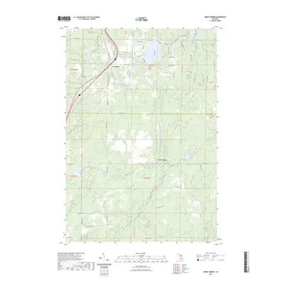
2023 Map of Green Timbers
USGS Topo · Published 2023About this map
The Sturgeon River carves a central path through this section of the northern Michigan landscape, defining a corridor of wetlands and tributaries across the border of Cheboygan and Otsego counties. The settlement of Trowbridge sits near the northwestern corner, positioned along a transportation corridor that includes the North Central State Trl and the Cornwell Grade RD, the latter reflecting the area's history of logging and resource management. This interior region is characterized by a high density of water bodies and streams, including Lance Lake, Pickerel Lake, and the winding Little Pigeon River. Toward the south, the namesake Green Timbers area and the prominence of Mount Vernon stand out as significant landmarks. The map also documents an extensive network of specialized recreational paths, such as the Tomahawk Motorcycle Trail C Loop, which interweave with secondary roads like Shire RD and Pitoniak RD through the wooded terrain.
Find a feature on this map
86 named features on this map. Tap any name to fly to it.
Don’t see what you’re looking for? This feature index may not catch every label — zoom into the map to look around manually.
Map Details
Editions of this 2023 Green Timbers Map
This is the sole edition of this map. No revisions or reprints were ever made.
Other maps of this area

1954 · Gaylord
USGS Topo · 1:62,500

1954 · Hetherton
USGS Topo · 1:62,500

1955 · Cheboygan
USGS Topo · 1:250,000

1957 · Tower
USGS Topo · 1:62,500

1957 · Wolverine
USGS Topo · 1:62,500

1958 · Cheboygan
USGS Topo · 1:250,000
1975 · Gaylord SW
USGS Topo · 1:24,000

1982 · Petoskey
USGS Topo · 1:100,000
1986 · Saunders Creek
USGS Topo · 1:24,000
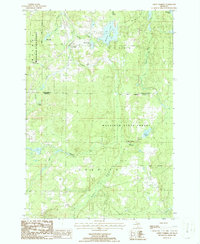
1986 · Green Timbers
USGS Topo · 1:24,000