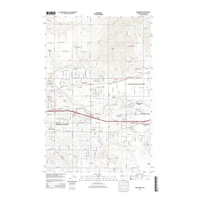
2014 Map of Greenacres
USGS Topo · Published 2014About this map
Antoine Peak rises over a landscape defined by the suburban and industrial expansion of Spokane Valley in this early 21st-century record. The Spokane River winds through the center of the sheet, flanked by heavy industrial sites like the Kaiser Works and the rail infrastructure of the Union Pacific line. Long-established communities such as Greenacres, Trentwood, and Veradale are shown in detail, alongside landmarks like the Inland Empire Zoo and Saint Josephs Cem. To the south, the terrain transitions into the distinct topography of Saltese Flats and Carlson Hill, while the northern portion retains more open space around Pleasant Prairie. This survey captures the region at a point of high density, where the historical farming roots of Otis Orchards-East Farms meet modern residential growth and thoroughfare development.
Find a feature on this map
79 named features on this map. Tap any name to fly to it.
Don’t see what you’re looking for? This feature index may not catch every label — zoom into the map to look around manually.
Map Details
Editions of this 2014 Greenacres Map
This is the sole edition of this map. No revisions or reprints were ever made.
Other maps of this area

1901 · Spokane
USGS Topo · 1:125,000

1943 · Mt Spokane
USGS Topo · 1:62,500

1949 · Deer Park
USGS Topo · 1:62,500

1949 · Greenacres
USGS Topo · 1:62,500

1950 · Spokane NE
USGS Topo · 1:24,000

1950 · Spokane SE
USGS Topo · 1:24,000

1950 · Mt Spokane
USGS Topo · 1:62,500

1950 · Spokane
USGS Topo · 1:62,500

1951 · Deer Park
USGS Topo · 1:62,500

1951 · Greenacres
USGS Topo · 1:62,500