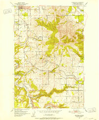
1950 Map of Spokane SE
USGS Topo · Published 1952About this map
Moran Prairie and the transition from the city of Spokane into the rolling highlands of southeastern Spokane County define this landscape in the early 1950s. The map illustrates a period when radio infrastructure was highly visible, marked by the KHQ Radio Towers, KREM Radio Towers, and KXLY Radio Tower grouped near the city limits. Moving south, the terrain rises toward Browne Mtn and Krell Hill, while the valley floors are carved by Latah Cr and California Creek. Small, dispersed settlements like Kiesling, Sharon, and Belair sit along the winding path of the Palouse Highway, which served as a primary artery before modern interstate developments. Local life is anchored by rural institutions such as the Sunnyside Sch and the Grange Hall, alongside transport nodes like the Great Northern railroad line.
Find a feature on this map
51 named features on this map. Tap any name to fly to it.
Don’t see what you’re looking for? This feature index may not catch every label — zoom into the map to look around manually.
Map Details
Editions of this 1950 Spokane SE Map
2 editions found

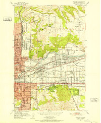
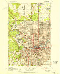
Other maps of this area

1901 · Spokane
USGS Topo · 1:125,000

1903 · Oakesdale
USGS Topo · 1:125,000

1905 · Oakesdale
USGS Topo · 1:125,000

1949 · Greenacres
USGS Topo · 1:62,500
1950 · Spokane NE
USGS Topo · 1:24,000

1950 · Spokane SW
USGS Topo · 1:24,000
1950 · Spokane NW
USGS Topo · 1:24,000

1950 · Spokane
USGS Topo · 1:62,500

1951 · Greenacres
USGS Topo · 1:62,500
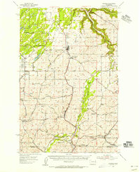
1954 · Spangle
USGS Topo · 1:62,500