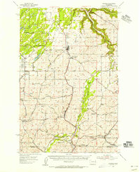
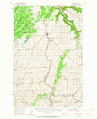
1954 Map of Spangle
USGS Topo · Published 1956About this map
The Northern Pacific and Chicago Milwaukee St Paul and Pacific railroads converge near Spangle, defining the agricultural and transport corridor of the Palouse region in the mid-1950s. This survey shows the transition from early 20th-century rural infrastructure to a post-war landscape, evidenced by several markers of educational shifts like Upper Columbia Academy and the defunct Buckeye Sch (Aband) and Prairie View Sch (Aband). Water resources such as Latah Creek and Philleo Lake provided the backbone for local settlements including North Pine and Freedom. To the west, the Turnbull National Wildlife Refuge preserves the unique channeled scablands terrain. The map also records the industrial footprint of the era through Grain Elevators near the Great Northern tracks and various Gravel Pits that supported road development like the Inland Empire Highway.
Find a feature on this map
32 named features on this map. Tap any name to fly to it.
Don’t see what you’re looking for? This feature index may not catch every label — zoom into the map to look around manually.
Map Details
Editions of this 1954 Spangle Map
2 editions found
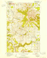
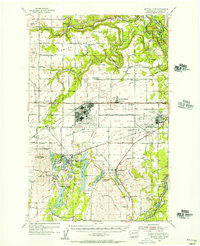
Other maps of this area

1901 · Spokane
USGS Topo · 1:125,000

1903 · Oakesdale
USGS Topo · 1:125,000

1905 · Oakesdale
USGS Topo · 1:125,000

1943 · Medical Lake
USGS Topo · 1:62,500

1949 · Greenacres
USGS Topo · 1:62,500
1950 · Spokane SE
USGS Topo · 1:24,000

1950 · Spokane SW
USGS Topo · 1:24,000

1950 · Spokane
USGS Topo · 1:62,500

1951 · Greenacres
USGS Topo · 1:62,500
1954 · Medical Lake
USGS Topo · 1:62,500