
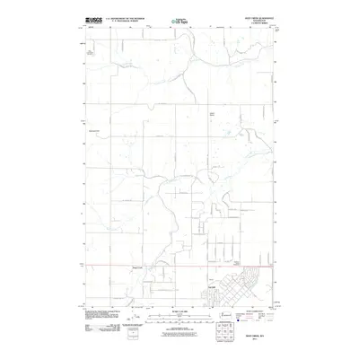
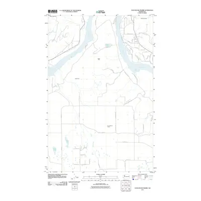
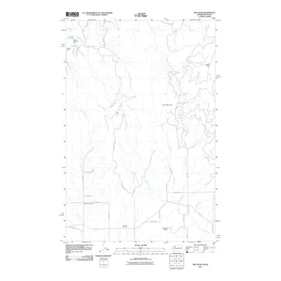
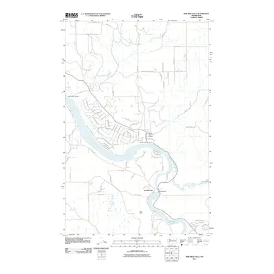
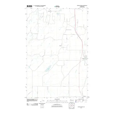
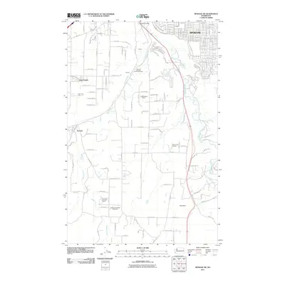
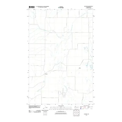
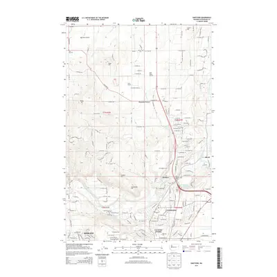
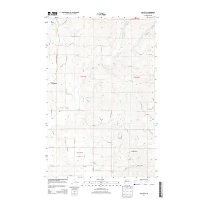
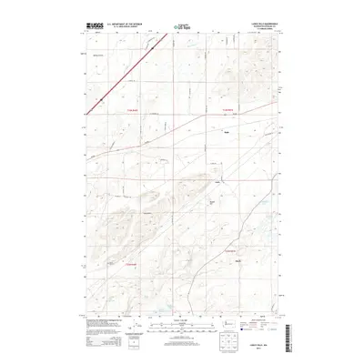
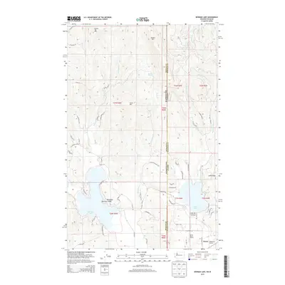
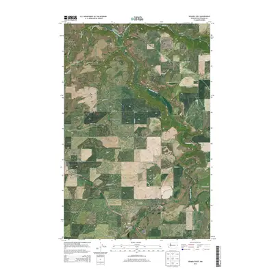
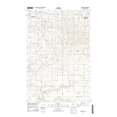
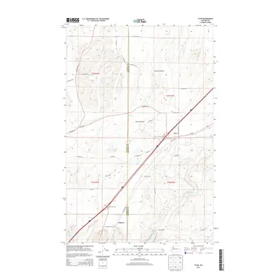
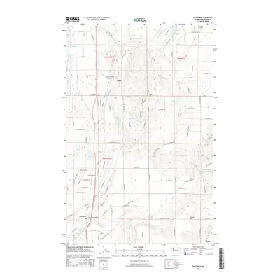
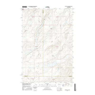
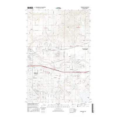
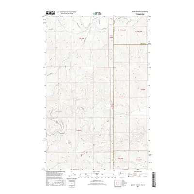
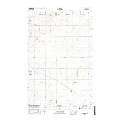
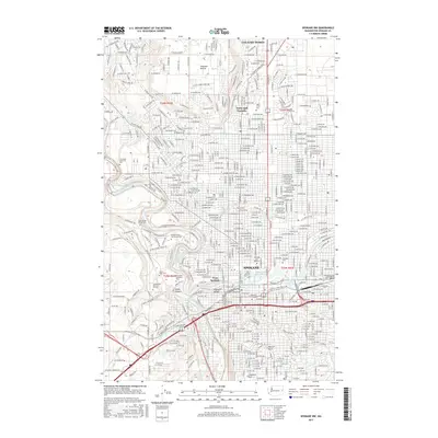
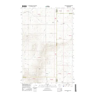
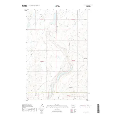
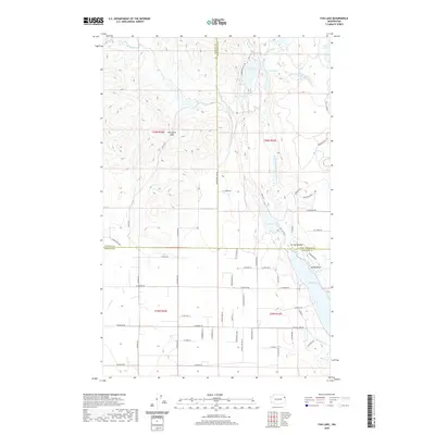
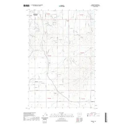
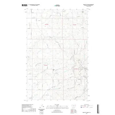
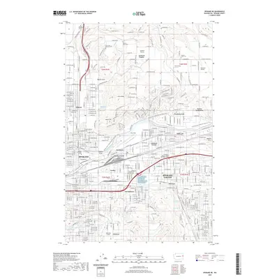
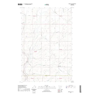
1950 Map of Spokane SW
USGS Topo · Published 1952About this map
The southwest outskirts of Spokane are defined by the steep descent toward Latah Creek and the busy rail corridors threading through Marshall. In the early 1950s, this area serves as a vital transportation junction where the Spokane Portland and Seattle, Great Northern, and Northern Pacific railroads all converge south of the city. The landscape transitions from the urbanized grid near Jefferson Jr High Sch and Comstock Park to the open agricultural plateau of Moran Prairie.
Find a feature on this map
38 named features on this map. Tap any name to fly to it.
Don’t see what you’re looking for? This feature index may not catch every label — zoom into the map to look around manually.
Map Details
Editions of this 1950 Spokane SW Map
This is the sole edition of this map. No revisions or reprints were ever made.
Historical Maps of Spokane Through Time
194 maps found

1943 Mt Spokane
Spokane County, WA

1949 Greenacres
Spokane County, WA

1950 Mt Spokane
Spokane County, WA

1950 Spokane NE
Spokane County, WA

1950 Spokane NW
Spokane County, WA

1950 Spokane SE
Spokane County, WA
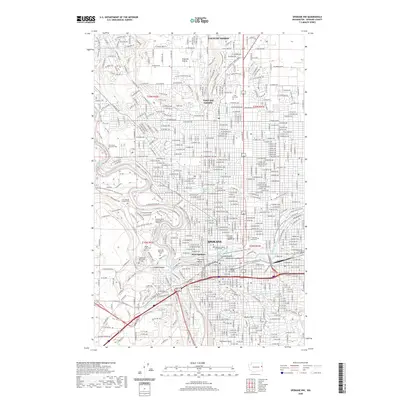
1950 Spokane SW
Spokane County, WA

1951 Greenacres
Spokane County, WA

1954 Deep Creek
Spokane County, WA

1963 Deep Creek
Spokane County, WA

1963 Spokane NE
Spokane County, WA

1963 Spokane NW
Spokane County, WA

1963 Spokane SE
Spokane County, WA

1963 Spokane SW
Spokane County, WA

1968 Fan Lake
Spokane County, WA

1973 Chattaroy
Spokane County, WA

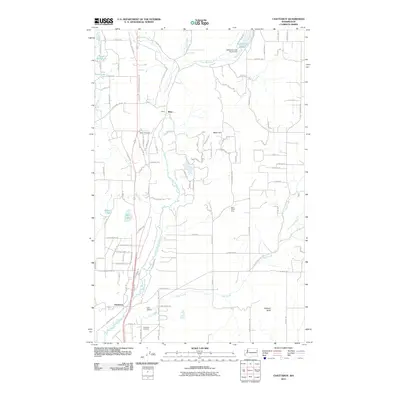
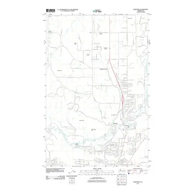
1973 Dartford
Spokane County, WA

1973 Deep Creek
Spokane County, WA

1973 Foothills
Spokane County, WA

1973 Four Mound Prairie
Spokane County, WA

1973 Freeman
Spokane County, WA

1973 Greenacres
Spokane County, WA

1973 Mica Peak
Spokane County, WA

1973 Mt. Kit Carson
Spokane County, WA

1973 Mt Spokane
Spokane County, WA

1973 Newman Lake
Spokane County, WA

1973 Nine Mile Falls
Spokane County, WA

1973 Reardan East
Spokane County, WA

1973 Spokane NE
Spokane County, WA

1973 Spokane SE
Spokane County, WA

1973 Spokane SW
Spokane County, WA

1973 Waukon
Spokane County, WA

1974 Spokane NW
Spokane County, WA

1975 Greenacres NE
Spokane County, WA

1978 Greenacres
Spokane County, WA

1978 Newman Lake
Spokane County, WA

1978 Spokane NE
Spokane County, WA

1978 Spokane NW
Spokane County, WA

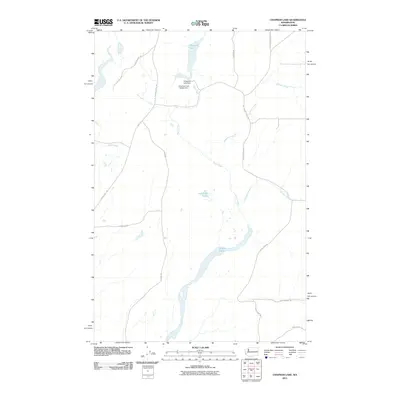
1980 Chapman Lake
Spokane County, WA

1980 Lance Hills
Spokane County, WA

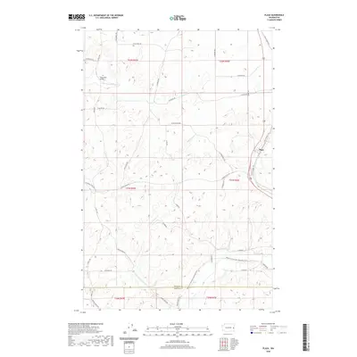
1980 Plaza
Spokane County, WA

1980 Spangle West
Spokane County, WA

1980 Spring Valley
Spokane County, WA

1980 Tekoa Mountain
Spokane County, WA

1980 Tyler
Spokane County, WA

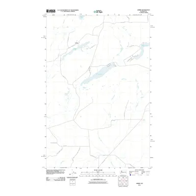
1981 Amber
Spokane County, WA

1981 Fishtrap Lake
Spokane County, WA

1981 Spangle East
Spokane County, WA

1996 Mount Spokane
Spokane County, WA
2011 Amber
Spokane County, WA
2011 Chapman Lake
Spokane County, WA
2011 Chattaroy
Spokane County, WA
2011 Dartford
Spokane County, WA
2011 Deep Creek
Spokane County, WA
2011 Fan Lake
Spokane County, WA
2011 Fishtrap Lake
Spokane County, WA
2011 Foothills
Spokane County, WA
2011 Four Mound Prairie
Spokane County, WA
2011 Freeman
Spokane County, WA
2011 Greenacres
Spokane County, WA
2011 Lance Hills
Spokane County, WA
2011 Mica Peak
Spokane County, WA
2011 Mount Kit Carson
Spokane County, WA
2011 Mount Spokane
Spokane County, WA
2011 Newman Lake
Spokane County, WA
2011 Nine Mile Falls
Spokane County, WA
2011 Plaza
Spokane County, WA
2011 Reardan East
Spokane County, WA
2011 Spangle East
Spokane County, WA
2011 Spangle West
Spokane County, WA
2011 Spokane NE
Spokane County, WA
2011 Spokane NW
Spokane County, WA
2011 Spokane SE
Spokane County, WA
2011 Spokane SW
Spokane County, WA
2011 Spring Valley
Spokane County, WA
2011 Tekoa Mountain
Spokane County, WA
2011 Tyler
Spokane County, WA
2011 Waukon
Spokane County, WA
2014 Amber
Spokane County, WA
2014 Chapman Lake
Spokane County, WA
2014 Chattaroy
Spokane County, WA
2014 Dartford
Spokane County, WA
2014 Deep Creek
Spokane County, WA
2014 Fan Lake
Spokane County, WA
2014 Fishtrap Lake
Spokane County, WA
2014 Foothills
Spokane County, WA
2014 Four Mound Prairie
Spokane County, WA
2014 Freeman
Spokane County, WA
2014 Greenacres
Spokane County, WA
2014 Lance Hills
Spokane County, WA
2014 Mica Peak
Spokane County, WA
2014 Mount Kit Carson
Spokane County, WA
2014 Mount Spokane
Spokane County, WA
2014 Newman Lake
Spokane County, WA
2014 Nine Mile Falls
Spokane County, WA
2014 Plaza
Spokane County, WA
2014 Reardan East
Spokane County, WA
2014 Spangle East
Spokane County, WA
2014 Spangle West
Spokane County, WA
2014 Spokane NE
Spokane County, WA
2014 Spokane NW
Spokane County, WA
2014 Spokane SE
Spokane County, WA
2014 Spokane SW
Spokane County, WA
2014 Spring Valley
Spokane County, WA
2014 Tekoa Mountain
Spokane County, WA
2014 Tyler
Spokane County, WA
2014 Waukon
Spokane County, WA
2017 Amber
Spokane County, WA
2017 Chapman Lake
Spokane County, WA
2017 Chattaroy
Spokane County, WA
2017 Dartford
Spokane County, WA
2017 Deep Creek
Spokane County, WA
2017 Fan Lake
Spokane County, WA
2017 Fishtrap Lake
Spokane County, WA
2017 Foothills
Spokane County, WA
2017 Four Mound Prairie
Spokane County, WA
2017 Freeman
Spokane County, WA
2017 Greenacres
Spokane County, WA
2017 Lance Hills
Spokane County, WA
2017 Mica Peak
Spokane County, WA
2017 Mount Kit Carson
Spokane County, WA
2017 Mount Spokane
Spokane County, WA
2017 Newman Lake
Spokane County, WA
2017 Nine Mile Falls
Spokane County, WA
2017 Plaza
Spokane County, WA
2017 Reardan East
Spokane County, WA
2017 Spangle East
Spokane County, WA
2017 Spangle West
Spokane County, WA
2017 Spokane NE
Spokane County, WA
2017 Spokane NW
Spokane County, WA
2017 Spokane SE
Spokane County, WA
2017 Spokane SW
Spokane County, WA
2017 Spring Valley
Spokane County, WA
2017 Tekoa Mountain
Spokane County, WA
2017 Tyler
Spokane County, WA
2017 Waukon
Spokane County, WA
2020 Amber
Spokane County, WA
2020 Chapman Lake
Spokane County, WA
2020 Chattaroy
Spokane County, WA
2020 Dartford
Spokane County, WA
2020 Deep Creek
Spokane County, WA
2020 Fan Lake
Spokane County, WA
2020 Fishtrap Lake
Spokane County, WA
2020 Foothills
Spokane County, WA
2020 Four Mound Prairie
Spokane County, WA
2020 Freeman
Spokane County, WA
2020 Greenacres
Spokane County, WA
2020 Lance Hills
Spokane County, WA
2020 Mica Peak
Spokane County, WA
2020 Mount Kit Carson
Spokane County, WA
2020 Mount Spokane
Spokane County, WA
2020 Newman Lake
Spokane County, WA
2020 Nine Mile Falls
Spokane County, WA
2020 Plaza
Spokane County, WA
2020 Reardan East
Spokane County, WA
2020 Spangle East
Spokane County, WA
2020 Spangle West
Spokane County, WA
2020 Spokane NE
Spokane County, WA
2020 Spokane NW
Spokane County, WA
2020 Spokane SE
Spokane County, WA
2020 Spokane SW
Spokane County, WA
2020 Spring Valley
Spokane County, WA
2020 Tekoa Mountain
Spokane County, WA
2020 Tyler
Spokane County, WA
2020 Waukon
Spokane County, WA

2023 Amber
Spokane County, WA

2023 Chapman Lake
Spokane County, WA

2023 Chattaroy
Spokane County, WA

2023 Dartford
Spokane County, WA

2023 Deep Creek
Spokane County, WA

2023 Fan Lake
Spokane County, WA

2023 Fishtrap Lake
Spokane County, WA

2023 Foothills
Spokane County, WA

2023 Four Mound Prairie
Spokane County, WA

2023 Freeman
Spokane County, WA

2023 Greenacres
Spokane County, WA

2023 Lance Hills
Spokane County, WA

2023 Mica Peak
Spokane County, WA

2023 Mount Kit Carson
Spokane County, WA

2023 Mount Spokane
Spokane County, WA

2023 Newman Lake
Spokane County, WA

2023 Nine Mile Falls
Spokane County, WA

2023 Plaza
Spokane County, WA

2023 Reardan East
Spokane County, WA

2023 Spangle East
Spokane County, WA

2023 Spangle West
Spokane County, WA

2023 Spokane NE
Spokane County, WA

2023 Spokane NW
Spokane County, WA

2023 Spokane SE
Spokane County, WA

2023 Spokane SW
Spokane County, WA

2023 Spring Valley
Spokane County, WA

2023 Tekoa Mountain
Spokane County, WA

2023 Tyler
Spokane County, WA

2023 Waukon
Spokane County, WA