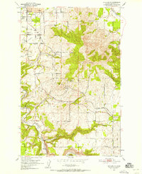
1950 Map of Spokane SE
USGS Topo · Published 1958About this map
Moran Prairie serves as the focal point of this mid-century landscape, where suburban expansion from Spokane meets the established agricultural character of the Palouse. The map records a transition in land use, documented by the presence of a landing strip, numerous radio towers like those of Kxly, and the community gathering point at the Grange Hall. This era of development is overlaid on a network of small, scattered settlements such as Kiesling, Sharon, and Excelsior, many of which were tied to the Great Northern and C M ST P & P rail lines. The topography is dominated by Browne Mtn and Krell Hill, with drainage provided by the winding Latah Creek and California Creek. For genealogists, the map preserves specific locations for the Moran Cem and Wood Memorial Cemetery, along with rural school sites including Sunnyside Sch and Adams Sch.
Find a feature on this map
47 named features on this map. Tap any name to fly to it.
Don’t see what you’re looking for? This feature index may not catch every label — zoom into the map to look around manually.
Map Details
Editions of this 1950 Spokane SE Map
2 editions found
Other maps of this area

1901 · Spokane
USGS Topo · 1:125,000

1903 · Oakesdale
USGS Topo · 1:125,000

1905 · Oakesdale
USGS Topo · 1:125,000

1949 · Greenacres
USGS Topo · 1:62,500

1950 · Spokane NE
USGS Topo · 1:24,000

1950 · Spokane SE
USGS Topo · 1:24,000

1950 · Spokane SW
USGS Topo · 1:24,000

1950 · Spokane NW
USGS Topo · 1:24,000

1950 · Spokane
USGS Topo · 1:62,500

1951 · Greenacres
USGS Topo · 1:62,500