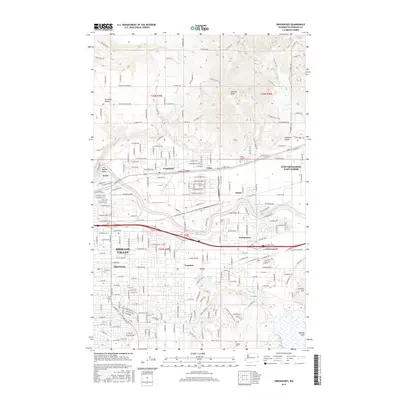
2017 Map of Greenacres
USGS Topo · Published 2017About this map
Spokane Valley serves as the industrial and residential heart of this region, where the Spokane River carves through a landscape shaped by both nature and heavy industry. Significant footprints such as the Kaiser Works and various industrial parks near Trentwood and Velox highlight the area's manufacturing legacy. The map reveals a dense suburban network stretching through Opportunity, Veradale, and Greenacres, illustrating the transition from the city's eastern edge toward the Idaho border.
Find a feature on this map
170 named features on this map. Tap any name to fly to it.
Don’t see what you’re looking for? This feature index may not catch every label — zoom into the map to look around manually.
Map Details
Editions of this 2017 Greenacres Map
This is the sole edition of this map. No revisions or reprints were ever made.
Other maps of this area

1901 · Spokane
USGS Topo · 1:125,000

1943 · Mt Spokane
USGS Topo · 1:62,500

1949 · Deer Park
USGS Topo · 1:62,500

1949 · Greenacres
USGS Topo · 1:62,500

1950 · Spokane NE
USGS Topo · 1:24,000

1950 · Spokane SE
USGS Topo · 1:24,000

1950 · Mt Spokane
USGS Topo · 1:62,500

1950 · Spokane
USGS Topo · 1:62,500

1951 · Deer Park
USGS Topo · 1:62,500

1951 · Greenacres
USGS Topo · 1:62,500