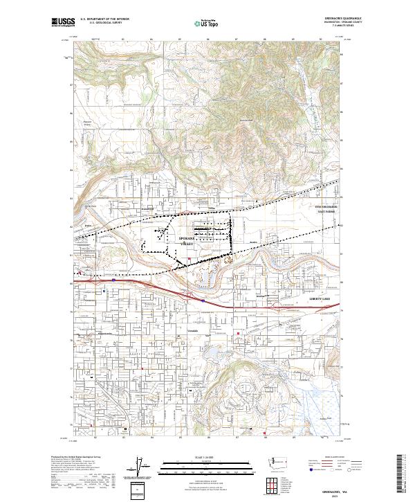
2023 Map of Greenacres
USGS Topo · Published 2023About this map
Spokane Valley dominates the central corridor of this survey, illustrating the dense suburban and industrial evolution of the region. The industrial footprint of the Kaiser Works facilities near Trentwood stands alongside older community markers like Saint Joseph Cem. The landscape transitions from the developed river valley to the prominent elevation of Antoine Peak and the drainage of Canfield Gulch in the north, while the southern reaches descend toward the Saltese Flats and Saltese Creek.
Find a feature on this map
139 named features on this map. Tap any name to fly to it.
Don’t see what you’re looking for? This feature index may not catch every label — zoom into the map to look around manually.
Map Details
Editions of this 2023 Greenacres Map
This is the sole edition of this map. No revisions or reprints were ever made.
Other maps of this area

1901 · Spokane
USGS Topo · 1:125,000

1943 · Mt Spokane
USGS Topo · 1:62,500

1949 · Deer Park
USGS Topo · 1:62,500

1949 · Greenacres
USGS Topo · 1:62,500

1950 · Spokane NE
USGS Topo · 1:24,000

1950 · Spokane SE
USGS Topo · 1:24,000

1950 · Mt Spokane
USGS Topo · 1:62,500

1950 · Spokane
USGS Topo · 1:62,500

1951 · Deer Park
USGS Topo · 1:62,500

1951 · Greenacres
USGS Topo · 1:62,500