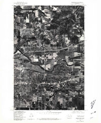
1978 Map of Greenacres
USGS Topo · Published 1981About this map
Greenacres and the surrounding Spokane Valley are captured in high detail in this 1978 orthophotograph, a period of significant suburban expansion and industrial transition. The Spokane River snakes through the center of the quadrangle, serving as a geographic anchor for the adjacent communities of Trentwood and Veradale. Unlike traditional line maps, this photographic survey reveals the precise textures of the land, from the organized grids of residential subdivisions to the large-scale industrial complexes and warehouses along the rail corridors. The imagery provides a clear view of the mid-century development patterns in eastern Washington, showing the dense clusters of housing pushing into formerly agricultural plots and the intricate network of roads and highway interchanges that connected these growing settlements to nearby Spokane.
Find a feature on this map
4 named features on this map. Tap any name to fly to it.
Don’t see what you’re looking for? This feature index may not catch every label — zoom into the map to look around manually.
Map Details
Editions of this 1978 Greenacres Map
This is the sole edition of this map. No revisions or reprints were ever made.
Other maps of this area

1901 · Spokane
USGS Topo · 1:125,000

1943 · Mt Spokane
USGS Topo · 1:62,500

1949 · Deer Park
USGS Topo · 1:62,500

1949 · Greenacres
USGS Topo · 1:62,500

1950 · Spokane NE
USGS Topo · 1:24,000

1950 · Spokane SE
USGS Topo · 1:24,000

1950 · Mt Spokane
USGS Topo · 1:62,500

1950 · Spokane
USGS Topo · 1:62,500

1951 · Deer Park
USGS Topo · 1:62,500

1951 · Greenacres
USGS Topo · 1:62,500