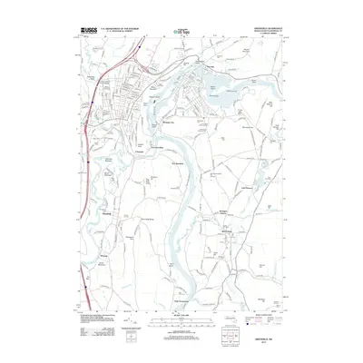
2012 Map of Greenfield
USGS Topo · Published 2012About this map
The Connecticut River and Deerfield River dominate this landscape, defining the industrial and agricultural character of the region. The map captures the complex water management at Turners Falls, where the Montague Power Canal Reservoir and various islands like Barton Island and Smead Island highlight the importance of the river to local industry. Significant elevation changes are marked by landmarks such as Poets Seat on Rocky Mountain and the Pocumtuck Range, providing a clear view of how settlements like Montague City and Cheapside developed around these natural barriers and the Pan Am Southern rail lines. Local history is deeply embedded in the terrain, from the Pumping Station Covered Bridge to the numerous burial grounds like Old Albany Cem and Our Lady of Czestochowski Cem. The presence of the Massachusetts State Fish Hatchery and Turners Falls Airport reflects the diverse utility of the Montague Plain.
Find a feature on this map
219 named features on this map. Tap any name to fly to it.
Don’t see what you’re looking for? This feature index may not catch every label — zoom into the map to look around manually.
Map Details
Editions of this 2012 Greenfield Map
This is the sole edition of this map. No revisions or reprints were ever made.
Other maps of this area

1885 · Northampton
USGS Topo · 1:62,500

1886 · Northampton
USGS Topo · 1:62,500

1887 · Warwick
USGS Topo · 1:62,500

1887 · Belchertown
USGS Topo · 1:62,500

1889 · Warwick
USGS Topo · 1:62,500

1890 · Belchertown
USGS Topo · 1:62,500

1890 · Greenfield
USGS Topo · 1:62,500

1891 · Northampton
USGS Topo · 1:62,500

1893 · Northampton
USGS Topo · 1:62,500

1893 · Belchertown
USGS Topo · 1:62,500