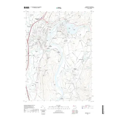
2018 Map of Greenfield
USGS Topo · Published 2018About this map
The Connecticut River and Deerfield River define this Massachusetts landscape, converging near Cheapside and East Greenfield. The terrain is marked by prominent elevations like Pocumtuck Rock and Rocky Mtn, which overlook the fertile Deerfield Meadows and North Meadows. This 2018 survey documents the complex industrial and transport heritage of the region, showing the Pan Am Southern railroad corridors and the layout of established industrial centers like Turners Falls and Montague City. Genealogists will find a wealth of burial grounds, ranging from the central Green River Cem to the peripheral Town Farm Cem and Marvell Cem. Notable local landmarks like the Pumping Station Covered Bridge and the Poets Seat tower reflect the area's long-standing civic identity, while the presence of Turners Falls Airport and modern infrastructure provides a clear view of the contemporary landscape as it existed in the late 2010s.
Find a feature on this map
258 named features on this map. Tap any name to fly to it.
Don’t see what you’re looking for? This feature index may not catch every label — zoom into the map to look around manually.
Map Details
Editions of this 2018 Greenfield Map
This is the sole edition of this map. No revisions or reprints were ever made.
Other maps of this area

1885 · Northampton
USGS Topo · 1:62,500

1886 · Northampton
USGS Topo · 1:62,500

1887 · Warwick
USGS Topo · 1:62,500

1887 · Belchertown
USGS Topo · 1:62,500

1889 · Warwick
USGS Topo · 1:62,500

1890 · Belchertown
USGS Topo · 1:62,500

1890 · Greenfield
USGS Topo · 1:62,500

1891 · Northampton
USGS Topo · 1:62,500

1893 · Northampton
USGS Topo · 1:62,500

1893 · Belchertown
USGS Topo · 1:62,500