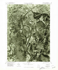
1975 Map of Greenfield
USGS Topo · Published 1981About this map
The confluence of the Connecticut River and its major tributaries defines the industrial and agricultural layout of this Franklin County region in the mid-1970s. As seen through this orthophotoquad, the dense grid of Greenfield sits above the sharp bend where the Green River meets the larger flows, while Turners Falls occupies the strategic riverside terrain to the east. The aerial imagery highlights the sharp contrast between the developed mill town centers and the broad, fertile plains surrounding Deerfield to the south. The landscape is deeply etched by water, from the winding path of the Deerfield River to the smaller Sawmill River and Fall River. Near Montague, the presence of Lake Pleasant and the entry of the Millers River show the complex hydrology that supported the area's historical settlement and manufacturing growth.
Find a feature on this map
11 named features on this map. Tap any name to fly to it.
Don’t see what you’re looking for? This feature index may not catch every label — zoom into the map to look around manually.
Map Details
Editions of this 1975 Greenfield Map
This is the sole edition of this map. No revisions or reprints were ever made.
Other maps of this area

1885 · Northampton
USGS Topo · 1:62,500

1886 · Northampton
USGS Topo · 1:62,500

1887 · Warwick
USGS Topo · 1:62,500

1887 · Belchertown
USGS Topo · 1:62,500

1889 · Warwick
USGS Topo · 1:62,500

1890 · Belchertown
USGS Topo · 1:62,500

1890 · Greenfield
USGS Topo · 1:62,500

1891 · Northampton
USGS Topo · 1:62,500

1893 · Northampton
USGS Topo · 1:62,500

1893 · Belchertown
USGS Topo · 1:62,500