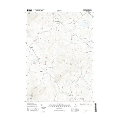
2015 Map of Greenfield
USGS Topo · Published 2015About this map
Francestown and Lyndeborough anchor this Southern New Hampshire landscape, where the settlement pattern follows the high ground and narrow river valleys. The terrain is defined by the prominent Wapack Range and peaks such as North Pack Monadnock Mtn and Rose Mtn, which frame the many water bodies dotting the region. Local history and genealogy are anchored by several dedicated burial grounds, including Greenvale Cem and the South Lyndeborough Cem. The map illustrates a complex network of colonial-era thoroughfares like the 2nd NH Tpke S, connecting smaller villages like Russell and South Lyndeborough. The hydrology of the area is equally central to its development, with the S Br Piscataquog River and Haunted Lake serving as significant geographic markers amidst the ridges and hills.
Find a feature on this map
105 named features on this map. Tap any name to fly to it.
Don’t see what you’re looking for? This feature index may not catch every label — zoom into the map to look around manually.
Map Details
Editions of this 2015 Greenfield Map
This is the sole edition of this map. No revisions or reprints were ever made.
Other maps of this area

1900 · Peterboro
USGS Topo · 1:62,500

1906 · Milford
USGS Topo · 1:62,500

1926 · Hillsboro
USGS Topo · 1:62,500

1927 · Concord
USGS Topo · 1:62,500

1929 · Hillsboro
USGS Topo · 1:62,500

1943 · Fitchburg
USGS Topo · 1:125,000

1948 · Boston
USGS Topo · 1:250,000

1949 · Portland
USGS Topo · 1:250,000

1949 · Concord
USGS Topo · 1:62,500
1953 · Peterborough
USGS Topo · 1:62,500