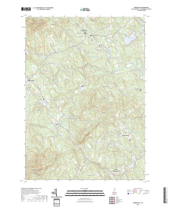
2024 Map of Greenfield
USGS Topo · Published 2024About this map
Francestown and Greenfield anchor a landscape defined by high ridges and traditional New England village centers in this contemporary survey of Hillsborough County. The terrain is dominated by significant elevations such as Crotched Mtn and Rose Mtn, which frame a network of brooks including Rand Brook and the South Branch Piscataquog River. For genealogists and local historians, the map identifies several distinct burial grounds, including Francestown Cem Number 2 and the Old Meeting House Cem, reflecting the early settlement patterns of these upland towns.
Find a feature on this map
133 named features on this map. Tap any name to fly to it.
Don’t see what you’re looking for? This feature index may not catch every label — zoom into the map to look around manually.
Map Details
Editions of this 2024 Greenfield Map
This is the sole edition of this map. No revisions or reprints were ever made.
Other maps of this area

1900 · Peterboro
USGS Topo · 1:62,500

1906 · Milford
USGS Topo · 1:62,500

1926 · Hillsboro
USGS Topo · 1:62,500

1927 · Concord
USGS Topo · 1:62,500

1929 · Hillsboro
USGS Topo · 1:62,500

1943 · Fitchburg
USGS Topo · 1:125,000

1948 · Boston
USGS Topo · 1:250,000

1949 · Portland
USGS Topo · 1:250,000

1949 · Concord
USGS Topo · 1:62,500
1953 · Peterborough
USGS Topo · 1:62,500