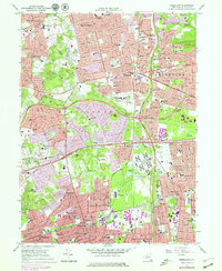
2023 Map of Greenlawn
USGS Topo · Published 2023About this map
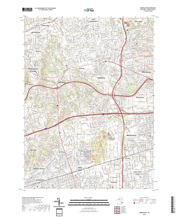
Long Island suburban density and transportation corridors define this contemporary landscape in central Suffolk County. The map shows a highly developed network of arterial parkways and rail lines, including the Long Island Rail Road and the crossing of the Northern State Pkwy and Sagtikos State Pkwy. Amidst the dense residential grids of Greenlawn, Dix Hills, and Brentwood, significant institutional footprints appear, such as Long Island University Brentwood and the Suffolk County Community College Michael J Grant Campus. A notable concentration of cemeteries, including the Pilgrim State Psychiatric Cem, occupies the central portion of the sheet. Recreational and conservation spaces like the Edgewood Hiking Tr and various bike trails near Deer Park provide a counterpoint to the surrounding residential expansion.
Find a feature on this map
47 named features on this map. Tap any name to fly to it.
Don’t see what you’re looking for? This feature index may not catch every label — zoom into the map to look around manually.
Map Details
Editions of this 2023 Greenlawn Map
This is the sole edition of this map. No revisions or reprints were ever made.
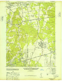
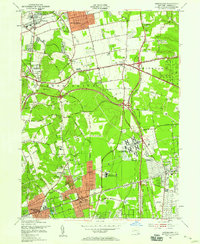
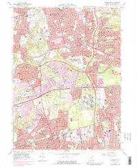
Historical Maps of North Babylon Through Time
5 maps found