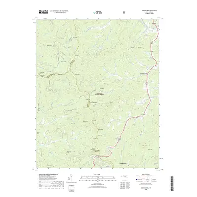
2019 Map of Greens Creek
USGS Topo · Published 2019About this map
Dillsboro sits at the northern edge of this terrain where the Tuckasegee River flows, serving as a gateway to the steep ridges of the Alarka Mountains and Cowee Mountains. This 2019 survey captures the geographic interface of Jackson, Swain, and Macon counties, a landscape dominated by the protected acreage of the Nantahala National Forest. The settlement pattern follows the narrow valley floors along Savannah Creek and Greens Creek, where small communities like Savannah, Gay, and Pumpkintown are linked by the winding path of Sylva Road.
Find a feature on this map
104 named features on this map. Tap any name to fly to it.
Don’t see what you’re looking for? This feature index may not catch every label — zoom into the map to look around manually.
Map Details
Editions of this 2019 Greens Creek Map
This is the sole edition of this map. No revisions or reprints were ever made.
Other maps of this area

1891 · Cowee
USGS Topo · 1:125,000

1897 · Cowee
USGS Topo · 1:125,000

1907 · Cowee
USGS Topo · 1:125,000

1933 · Bryson
USGS Topo · 1:62,500

1935 · Franklin
USGS Topo · 1:24,000

1935 · Cullowhee
USGS Topo · 1:24,000

1935 · Addie
USGS Topo · 1:24,000

1935 · Glenville
USGS Topo · 1:24,000

1935 · Corbin Knob
USGS Topo · 1:24,000
1936 · Greens Creek
USGS Topo · 1:24,000