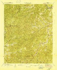
1941 Map of Greens Creek
USGS Topo · Published 1941About this map
The Tuckasegee River cuts through the northeast corner of this 1941 landscape, where the Southern Railway and U. S. 23 connect the town of Dillsboro to the surrounding highlands. This area is defined by the sharp boundaries of the Nantahala National Forest and the convergence of Jackson, Swain, and Macon counties. High elevation landmarks like the Cowee Bald Lookout Tower on Cowee Bald provide strategic oversight of a territory deeply divided by ridges such as Rocky Knob Ridge and Messer Mountain.
Find a feature on this map
61 named features on this map. Tap any name to fly to it.
Don’t see what you’re looking for? This feature index may not catch every label — zoom into the map to look around manually.
Map Details
Editions of this 1941 Greens Creek Map
This is the sole edition of this map. No revisions or reprints were ever made.
Other maps of this area

1891 · Cowee
USGS Topo · 1:125,000

1897 · Cowee
USGS Topo · 1:125,000

1907 · Cowee
USGS Topo · 1:125,000

1933 · Bryson
USGS Topo · 1:62,500

1935 · Franklin
USGS Topo · 1:24,000

1935 · Cullowhee
USGS Topo · 1:24,000

1935 · Addie
USGS Topo · 1:24,000

1935 · Glenville
USGS Topo · 1:24,000

1935 · Corbin Knob
USGS Topo · 1:24,000
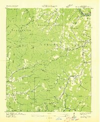
1936 · Greens Creek
USGS Topo · 1:24,000