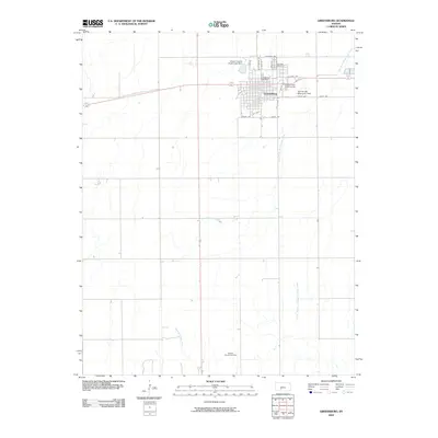
2009 Map of Greensburg
USGS Topo · Published 2009About this map
Greensburg stands as the central hub of this Kansas landscape, defined by its grid of streets such as California Ave and S Olive St. The town's local infrastructure is well-documented, featuring the Greensburg Post Office, Cannonball Golf Course, and Paul Windle Municipal Field. To the north, the Kiowa County State Lake Dam manages local waters, while Fairview Cemetery provides a primary point of interest for genealogists tracing Kiowa County family roots.
Find a feature on this map
22 named features on this map. Tap any name to fly to it.
Don’t see what you’re looking for? This feature index may not catch every label — zoom into the map to look around manually.
Map Details
Editions of this 2009 Greensburg Map
This is the sole edition of this map. No revisions or reprints were ever made.
Other maps of this area

1889 · Kinsley
USGS Topo · 1:125,000

1892 · Kinsley
USGS Topo · 1:125,000

1892 · Coldwater
USGS Topo · 1:125,000

1894 · Kinsley
USGS Topo · 1:125,000

1955 · Pratt
USGS Topo · 1:250,000

1959 · Pratt
USGS Topo · 1:250,000

1968 · Haviland NW
USGS Topo · 1:24,000

1968 · Brenham
USGS Topo · 1:24,000

1969 · Greensburg NW
USGS Topo · 1:24,000
1969 · Greensburg
USGS Topo · 1:24,000