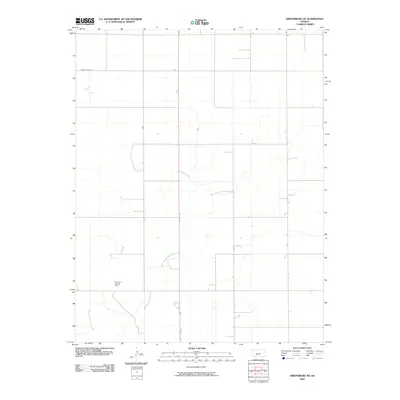
2009 Map of Greensburg NE
USGS Topo · Published 2009About this map
Einsel Oil and Gas Field sits in the southwestern portion of this Kiowa County landscape, marking the intersection of the region's energy economy and its natural drainage patterns. The terrain is defined by the winding course of Rattlesnake Creek and its tributary, the South Branch Rattlesnake Creek, which cut through the agricultural sections. The map reveals a strict rectilinear grid of rural roads, anchored by the north-south transit of US Hwy 183 and the horizontal boundary of County Line Rd at the northern edge. This survey provides a clear view of the mid-plains rural infrastructure before later 21st-century developments, showing how property lines and transportation corridors were established in relation to the seasonal watercourses and the local petroleum industry.
Find a feature on this map
5 named features on this map. Tap any name to fly to it.
Don’t see what you’re looking for? This feature index may not catch every label — zoom into the map to look around manually.
Map Details
Editions of this 2009 Greensburg NE Map
This is the sole edition of this map. No revisions or reprints were ever made.
Other maps of this area

1889 · Kinsley
USGS Topo · 1:125,000

1892 · Kinsley
USGS Topo · 1:125,000

1894 · Kinsley
USGS Topo · 1:125,000

1955 · Pratt
USGS Topo · 1:250,000

1959 · Pratt
USGS Topo · 1:250,000

1968 · Haviland NW
USGS Topo · 1:24,000

1968 · Brenham
USGS Topo · 1:24,000

1969 · Greensburg NW
USGS Topo · 1:24,000
1969 · Greensburg
USGS Topo · 1:24,000
1969 · Mullinville
USGS Topo · 1:24,000