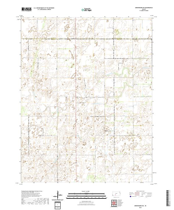
2022 Map of Greensburg NE
USGS Topo · Published 2022About this map
The prairie lands of south-central Kansas are defined here by the winding course of Rattlesnake Cr and its tributary, the S Br Rattlesnake Cr. This landscape is primarily rural, situated along the county line between Edwards and Kiowa counties. The terrain is characterized by a strict orthogonal grid of roads, ranging from 120th Ave to 170th Ave, which partition the agricultural sections. The systematic nomenclature of the local road network, including alphabetic identifiers like KC A St and KC G St, reflects the organized land management of the Kansas high plains. Numerous depressions and small wetlands are scattered throughout the sections, particularly within Township 27 South, Range 19 West, indicating the subtle drainage patterns that feed into the Rattlesnake Creek basin. This survey provides a precise look at the land's hydrology and modern rural infrastructure.
Find a feature on this map
28 named features on this map. Tap any name to fly to it.
Don’t see what you’re looking for? This feature index may not catch every label — zoom into the map to look around manually.
Map Details
Editions of this 2022 Greensburg NE Map
This is the sole edition of this map. No revisions or reprints were ever made.
Other maps of this area

1889 · Kinsley
USGS Topo · 1:125,000

1892 · Kinsley
USGS Topo · 1:125,000

1894 · Kinsley
USGS Topo · 1:125,000

1955 · Pratt
USGS Topo · 1:250,000

1959 · Pratt
USGS Topo · 1:250,000

1968 · Haviland NW
USGS Topo · 1:24,000

1968 · Brenham
USGS Topo · 1:24,000

1969 · Greensburg NW
USGS Topo · 1:24,000
1969 · Greensburg
USGS Topo · 1:24,000
1969 · Mullinville
USGS Topo · 1:24,000