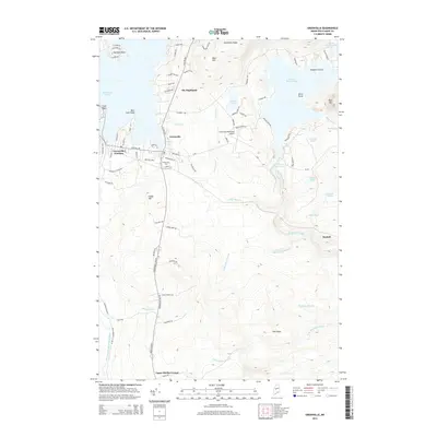
2014 Map of Greenville
USGS Topo · Published 2014About this map
Greenville serves as the focal point of this 2014 survey, situated at the southern tip of Moosehead Lake. The landscape transition from the lakeside community to the surrounding highlands is marked by several distinct residential and geographic clusters, including The Highlands and Harfords Point. A network of water bodies, from the sprawling Lower Wilson Pond to the smaller Sawyer Pond, illustrates the hydrologic complexity of the region as it feeds into Big Wilson Stream and the East Branch Piscataquis River.
Find a feature on this map
85 named features on this map. Tap any name to fly to it.
Don’t see what you’re looking for? This feature index may not catch every label — zoom into the map to look around manually.
Map Details
Editions of this 2014 Greenville Map
This is the sole edition of this map. No revisions or reprints were ever made.
Other maps of this area

1920 · Moosehead Lake
USGS Topo · 1:62,500

1922 · Moosehead Lake
USGS Topo · 1:62,500

1930 · Moosehead Lake
USGS Topo · 1:62,500

1944 · Moosehead Lake
USGS Topo · 1:62,500

1950 · Sebec Lake
USGS Topo · 1:62,500

1951 · Greenville
USGS Topo · 1:62,500

1952 · First Roach Pond
USGS Topo · 1:62,500

1954 · Millinocket
USGS Topo · 1:250,000

1957 · Moosehead Lake
USGS Topo · 1:62,500

1958 · Millinocket
USGS Topo · 1:250,000
Featured Places
- Greenville, ME
- Shirley, ME
- Greenville Junction, Greenville
- Cove Point Township, ME
- Moosehead Junction Township, ME