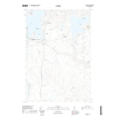
2021 Map of Greenville
USGS Topo · Published 2021About this map
Moosehead Lake defines the northwestern reaches of this Maine landscape, where the settlements of Greenville and Greenville Junction serve as the primary hubs. The 2021 topography reveals a transition from the developed waterfronts at West Cove and Harfords Point to the elevated terrain of Blair Hill and Indian Hill. Local infrastructure is anchored by the Greenville Municipal Airport and a network of arterial roads like Moosehead Lake Rd and Katahdin Ironworks Rd that push into the timberlands.
Find a feature on this map
46 named features on this map. Tap any name to fly to it.
Don’t see what you’re looking for? This feature index may not catch every label — zoom into the map to look around manually.
Map Details
Editions of this 2021 Greenville Map
This is the sole edition of this map. No revisions or reprints were ever made.
Other maps of this area

1920 · Moosehead Lake
USGS Topo · 1:62,500

1922 · Moosehead Lake
USGS Topo · 1:62,500

1930 · Moosehead Lake
USGS Topo · 1:62,500

1944 · Moosehead Lake
USGS Topo · 1:62,500

1950 · Sebec Lake
USGS Topo · 1:62,500

1951 · Greenville
USGS Topo · 1:62,500

1952 · First Roach Pond
USGS Topo · 1:62,500

1954 · Millinocket
USGS Topo · 1:250,000

1957 · Moosehead Lake
USGS Topo · 1:62,500

1958 · Millinocket
USGS Topo · 1:250,000
Featured Places
- Greenville, ME
- Shirley, ME
- Greenville Junction, Greenville
- Cove Point Township, ME
- Moosehead Junction Township, ME