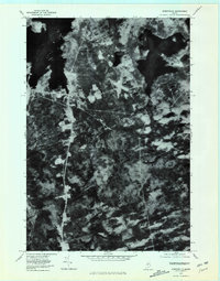
1977 Map of Greenville
USGS Topo · Published 1981About this map
Greenville Junction and the town of Greenville anchor this orthophotoquad, which captures the southern reaches of Moosehead Lake as they appeared in the late 1970s. This aerial perspective, prepared from November 1977 photography, provides an unfiltered view of the dense Maine woods and the complex water systems that defined the region's development. The clear-cut runways of the local airport stand out against the forest, while the drainage of the Piscataquis River and Big Wilson Stream trace the low-lying terrain south of The Highlands. To the east, the large expanse of Lower Wilson Pond is visible, fed by the winding Coffee House Stream. This photographic study is particularly valuable for researchers tracing land use patterns and the exact footprint of forest clearings and road networks before the turn of the century.
Find a feature on this map
8 named features on this map. Tap any name to fly to it.
Don’t see what you’re looking for? This feature index may not catch every label — zoom into the map to look around manually.
Map Details
Editions of this 1977 Greenville Map
This is the sole edition of this map. No revisions or reprints were ever made.
Other maps of this area

1920 · Moosehead Lake
USGS Topo · 1:62,500

1922 · Moosehead Lake
USGS Topo · 1:62,500

1930 · Moosehead Lake
USGS Topo · 1:62,500

1944 · Moosehead Lake
USGS Topo · 1:62,500

1950 · Sebec Lake
USGS Topo · 1:62,500

1951 · Greenville
USGS Topo · 1:62,500

1952 · First Roach Pond
USGS Topo · 1:62,500

1954 · Millinocket
USGS Topo · 1:250,000

1957 · Moosehead Lake
USGS Topo · 1:62,500

1958 · Millinocket
USGS Topo · 1:250,000
Featured Places
- Greenville, ME
- Shirley, ME
- Harfords Point Township, ME
- Moosehead Junction Township, ME
- Elliottsville Township, ME