
2022 Map of Gribbles Park
USGS Topo · Published 2022About this map
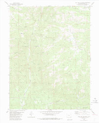
San Isabel National Forest encompasses the western reaches of this Fremont and Park County borderland, where the terrain transitions through high-elevation parks and gulches. The landscape is defined by its water sources and historical transit routes, most notably the Ute Trl, which traverses the southern portion of the map. Central to the geography is Gribbles Park, a high mountain basin drained by Gribbles Run and Rock Cr. Numerous natural water features suggest a history of seasonal grazing and movement, including the curiously named Suckerville Spring and Mud Spring. A network of rural roads such as Badger Creek Rd and Gribbles Run Rd provide access to the remote draws of Antelope Gulch and Long Gulch, marking the enduring infrastructure of this high-country drainage system at the headwaters of Badger Cr.
Find a feature on this map
33 named features on this map. Tap any name to fly to it.
Don’t see what you’re looking for? This feature index may not catch every label — zoom into the map to look around manually.
Map Details
Editions of this 2022 Gribbles Park Map
This is the sole edition of this map. No revisions or reprints were ever made.
Other maps of this area

1954 · Pueblo
USGS Topo · 1:250,000

1956 · Cameron Mountain
USGS Topo · 1:62,500

1957 · Pueblo
USGS Topo · 1:250,000

1958 · Pueblo
USGS Topo · 1:250,000

1959 · Antero Reservoir
USGS Topo · 1:62,500

1959 · Black Mountain
USGS Topo · 1:62,500

1959 · Guffey
USGS Topo · 1:62,500

1962 · Pueblo
USGS Topo · 1:250,000

1966 · Pueblo
USGS Topo · 1:250,000
1983 · Jack Hall Mountain
USGS Topo · 1:24,000