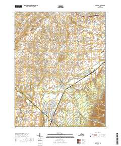
2019 Map of Grottoes
USGS Topo · Published 2019About this map
The South Fork Shenandoah River system converges in this portion of the Shenandoah Valley, where the North River and South River meet at Port Republic. This historic river junction sits adjacent to the Norfolk Southern rail line, which services the larger town of Grottoes to the south. The landscape reflects a deeply rooted rural community, with family and church-affiliated burial grounds such as Port Republic Cem, Shady Grove Cem, and Old Forge Cem scattered between agricultural holdings and small settlements like Cross Keys and Goods Mill. To the east, the terrain rises sharply from the Page Valley floor into the western boundary of Shenandoah National Park, marked by the prominent peak of Austin Mtn. The map preserves the layout of local infrastructure, including numerous named roads such as Battlefield Rd and Snowflake Mill Rd, which hint at the region's complex 19th-century history.
Find a feature on this map
151 named features on this map. Tap any name to fly to it.
Don’t see what you’re looking for? This feature index may not catch every label — zoom into the map to look around manually.
Map Details
Editions of this 2019 Grottoes Map
This is the sole edition of this map. No revisions or reprints were ever made.
Other maps of this area

1892 · Harrisonburg
USGS Topo · 1:125,000

1931 · University
USGS Topo · 1:62,500

1934 · Waynesboro
USGS Topo · 1:48,000

1935 · University
USGS Topo · 1:62,500

1937 · Elkton
USGS Topo · 1:62,500

1939 · Waynesboro
USGS Topo · 1:62,500

1941 · Harrisonburg
USGS Topo · 1:62,500

1943 · Harrisonburg
USGS Topo · 1:62,500

1949 · Charlottesville
USGS Topo · 1:250,000

1956 · Charlottesville
USGS Topo · 1:250,000