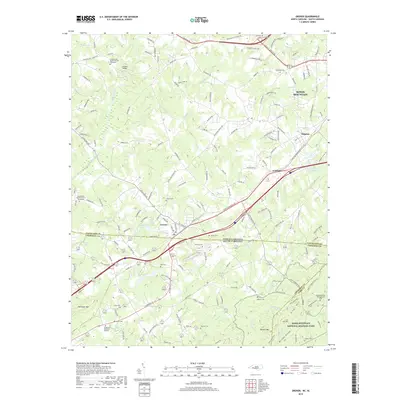
2019 Map of Grover
USGS Topo · Published 2019About this map
Grover sits directly on the state line where Cleveland County, North Carolina, meets Cherokee County, South Carolina. This modern topographic view highlights a landscape shaped by historical memory and the foothills of the Blue Ridge, dominated by the northern portion of Kings Mountain National Military Park. The terrain is defined by prominent elevations such as Whitaker Mtn, Browns Mtn, and the spine of Brushy Ridge. The settlement pattern follows a dense network of country roads and creek valleys, including Buffalo Creek and Beason Cr. Numerous family and church burial grounds, such as the New Buffalo Baptist Church Graveyard and Antioch Cem, are documented throughout the rural landscape, offering significant detail for genealogical research. The map also captures local landmarks like Buffalo Bridge and the Kings Mountain Battlefield Cem, marking the intersection of regional history and modern geography.
Find a feature on this map
173 named features on this map. Tap any name to fly to it.
Don’t see what you’re looking for? This feature index may not catch every label — zoom into the map to look around manually.
Map Details
Editions of this 2019 Grover Map
This is the sole edition of this map. No revisions or reprints were ever made.
Other maps of this area

1906 · Kings Mountain
USGS Topo · 1:62,500

1908 · Kings Mountain
USGS Topo · 1:62,500

1909 · Gaffney
USGS Topo · 1:62,500

1909 · Lincolnton
USGS Topo · 1:62,500

1911 · Lincolnton
USGS Topo · 1:62,500

1950 · Shelby
USGS Topo · 1:62,500

1953 · Charlotte
USGS Topo · 1:250,000

1954 · Charlotte
USGS Topo · 1:250,000

1960 · Charlotte
USGS Topo · 1:250,000

1962 · Charlotte
USGS Topo · 1:250,000