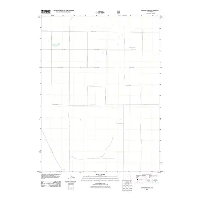
2011 Map of Grover North
USGS Topo · Published 2011About this map
Grover sits at the southern edge of this Weld County landscape, where the high plains transition into a strictly organized grid of agricultural and transport corridors. The map reveals a highly structured rural environment defined by an extensive network of thoroughfares, including County Rd-138 in the north and the diagonal route of County Rd-390 leading into the settlement. Industrial history is represented by the Furney Manganese Prospect in the northeastern quadrant, suggesting the mineral interests that once drew attention to this section of the Colorado plains. This 2011 survey documents the persistent township-and-range geometry that has governed land use and travel in the region for generations, showing the connection between the small hub of Grover and its surrounding homesteads and prospects via roads like County Rd-89 and County Rd-130.
Find a feature on this map
15 named features on this map. Tap any name to fly to it.
Don’t see what you’re looking for? This feature index may not catch every label — zoom into the map to look around manually.
Map Details
Editions of this 2011 Grover North Map
This is the sole edition of this map. No revisions or reprints were ever made.
Other maps of this area
1954 · Cheyenne
USGS Topo · 1:250,000
1954 · Greeley
USGS Topo · 1:250,000
1957 · Greeley
USGS Topo · 1:250,000
1958 · Cheyenne
USGS Topo · 1:250,000
1958 · Greeley
USGS Topo · 1:250,000
1961 · Greeley
USGS Topo · 1:250,000
1963 · Pine Bluffs SE
USGS Topo · 1:24,000
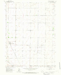
1963 · Carpenter
USGS Topo · 1:24,000
1963 · Pine Bluffs SW
USGS Topo · 1:24,000
1964 · Greeley
USGS Topo · 1:250,000