Loading...
Loading map...2024 Map of Groveton
USGS Topo · Published 2024About this map
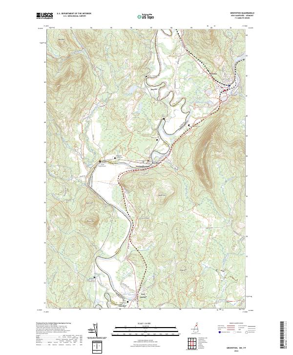
The Connecticut River serves as the winding border between Vermont and New Hampshire in this contemporary topographical view, framing the historic riverfront communities of Northumberland and Guildhall. On the Vermont side, the Essex County Courthouse stands as a significant civic landmark near Court House Hill Cem. Across the water, the settlement of Groveton is situated at the confluence of the river and the Upper Ammonoosuc River.
Find a feature on this map
82 named features on this map. Tap any name to fly to it.
Don’t see what you’re looking for? This feature index may not catch every label — zoom into the map to look around manually.
Map Details
Date Portrayed2024
Date Published2024
PublisherU.S. Geological Survey
Map TypeTopographic
Scale1:24000
Physical Dimensions24 x 29 inches
Editions of this 2024 Groveton Map
This is the sole edition of this map. No revisions or reprints were ever made.
Historical Maps of Maidstone Through Time
Featured Locations
Source Details
SourceU.S. Geological Survey
CopyrightPublic Domain