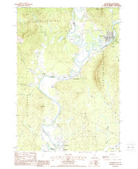
1988 Map of Groveton
USGS Topo · Published 1988About this map
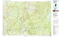
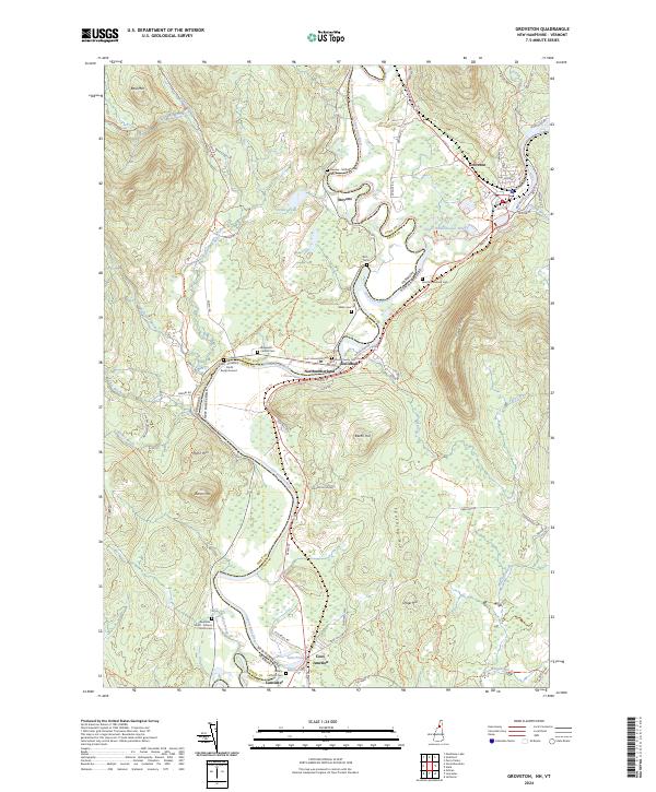
The Connecticut River defines the border between New Hampshire and Vermont in this late-twentieth-century study, winding through a landscape shaped by river commerce and rail history. Near the confluence with the Upper Ammonoosuc River, the village of Groveton serves as a primary hub of activity, featuring a large Sewage Disposal Plant and nearby industrial infrastructure. The map records the persistence of historical transportation routes, including an Old Railroad Grade and the Guildhall Sta stop, illustrating how these valley towns evolved from earlier timber and rail dependencies. Local landmarks like the Covered Bridge near Guildhall provide a connection to the region's heritage, while the surrounding terrain is punctuated by prominent elevations such as Cape Horn and Beech Hill. The map also captures several smaller settlements and family-named landmarks, including Stevens and Coos Junction near the southern boundary of Lancaster.
Find a feature on this map
43 named features on this map. Tap any name to fly to it.
Don’t see what you’re looking for? This feature index may not catch every label — zoom into the map to look around manually.
Map Details
Editions of this 1988 Groveton Map
This is the sole edition of this map. No revisions or reprints were ever made.
Historical Maps of Lancaster Through Time
7 maps found