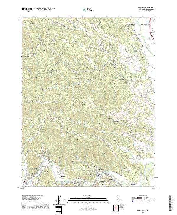
2021 Map of Guerneville
USGS Topo · Published 2021About this map
The Russian River winds through the southern portion of this region, creating a distinctive settlement pattern where numerous small communities and vacation enclaves cluster along the riverbanks. Named locations such as Guerneville, Rio Nido, and Korbel sit at the base of steep ridges like Mount Jackson and Newgate Ridge. The landscape is defined by deep canyons and gulches, including Pasquini Canyon and Renevar Gulch, which feed into the main river system. Near the river’s edge, specialized developments like Summerhome Park, Hacienda, and Russian River Terrace illustrate the area's history as a recreational and residential corridor. To the north, the terrain transitions into the steep slopes of Marble Mine Ridge and Queens Peak, while the northeast corner shows the edge of Healdsburg near Dry Creek. This map captures the intricate geography of the Russian River Valley, documenting local landmarks like McPeak Cem and Redwood Memorial Gardens.
Find a feature on this map
121 named features on this map. Tap any name to fly to it.
Don’t see what you’re looking for? This feature index may not catch every label — zoom into the map to look around manually.
Map Details
Editions of this 2021 Guerneville Map
This is the sole edition of this map. No revisions or reprints were ever made.
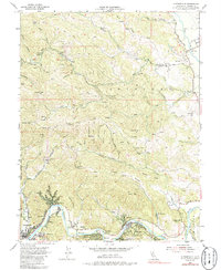
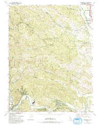
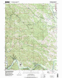
Historical Maps of Mount Jackson Through Time
4 maps found