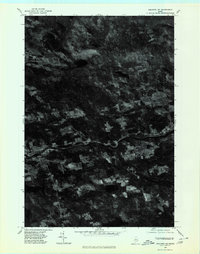
1975 Map of Guilford NE
USGS Topo · Published 1980About this map
The Piscataquis River carves a distinct path through this central Maine landscape, which is shown through aerial photography from the mid-1970s. The orthophotoquad format reveals the specific clearing patterns of the era, contrasting the dense forest canopy with the rectangular agricultural plots and pastures surrounding Dunham Corner and East Sangerville. Small-scale settlement is concentrated in the riverside community of Guilford and the inland hub of Guilford Center, where local road networks branch out to connect family farmsteads. This visual record provides a rare look at the exact land use and woodlot boundaries as they existed before decades of reforestation and modernization altered the Piscataquis County countryside.
Find a feature on this map
5 named features on this map. Tap any name to fly to it.
Don’t see what you’re looking for? This feature index may not catch every label — zoom into the map to look around manually.
Map Details
Editions of this 1975 Guilford NE Map
This is the sole edition of this map. No revisions or reprints were ever made.
Other maps of this area

1932 · Dover-Foxcroft
USGS Topo · 1:48,000

1933 · Guilford
USGS Topo · 1:62,500

1935 · Dover-Foxcroft
USGS Topo · 1:62,500

1937 · Guilford
USGS Topo · 1:62,500

1940 · Sebec
USGS Topo · 1:48,000

1943 · Sebec
USGS Topo · 1:62,500

1950 · Sebec Lake
USGS Topo · 1:62,500

1954 · Millinocket
USGS Topo · 1:250,000

1958 · Millinocket
USGS Topo · 1:250,000

1960 · Millinocket
USGS Topo · 1:250,000