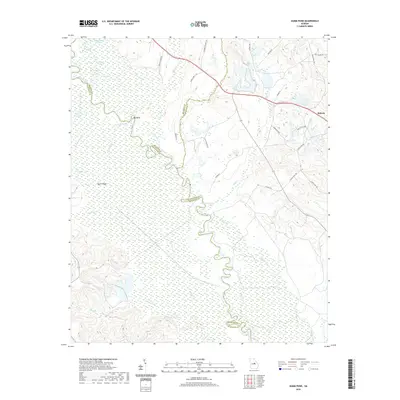
2020 Map of Gumm Pond
USGS Topo · Published 2020About this map
The Oconee River meanders through a dense network of swampy lowlands and secondary channels at the borders of Baldwin, Wilkinson, and Washington Counties. This part of Georgia is defined by its complex hydrology, where features like Gumm Pond, Dead River, and Crooked Slough indicate an ever-shifting riverbed. To the west, the elevation rises toward Beech Ridge, while the eastern uplands near the settlement of Hebron show evidence of local industry at the Harrison Mine. The map traces numerous named water bodies within the river basin, including Steel Trap Lake, High Bridge Lake, and Adams Pond, providing a detailed look at the riparian landscape before it reaches the southern confluence with Buck Creek. Local road networks like Indian Trail Rd and Old Oconee Rd connect these remote wetlands to the small communities on the ridges.
Find a feature on this map
49 named features on this map. Tap any name to fly to it.
Don’t see what you’re looking for? This feature index may not catch every label — zoom into the map to look around manually.
Map Details
Editions of this 2020 Gumm Pond Map
This is the sole edition of this map. No revisions or reprints were ever made.
Other maps of this area

1912 · Milledgeville
USGS Topo · 1:62,500

1916 · Irwinton
USGS Topo · 1:62,500

1920 · Irwinton
USGS Topo · 1:62,500

1953 · Athens
USGS Topo · 1:250,000

1957 · Macon
USGS Topo · 1:250,000

1958 · Macon
USGS Topo · 1:250,000

1958 · Athens
USGS Topo · 1:250,000

1959 · Athens
USGS Topo · 1:250,000

1961 · Deepstep
USGS Topo · 1:24,000

1962 · Oconee
USGS Topo · 1:24,000