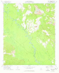
1973 Map of Gumm Pond
USGS Topo · Published 1977About this map
The Oconee River carves a winding path through the center of this landscape, marking the tri-county meeting point of Baldwin, Wilkinson, and Washington counties. In the early 1970s, this region was characterized by an intricate network of wetlands and oxbow lakes, including Peachtree Lake, Steel Trap Lake, and the expansive Gumm Pond. The map reveals a land defined by its water and industrial extraction, with numerous Claypits and associated tailings ponds concentrated in the eastern uplands. Local life is anchored by rural landmarks such as Gumm Hill Church and Olive Hill Church, while the small settlement of Hebron sits near the eastern boundary. Notable topographic details like Beech Ridge and the Big Bend of the river highlight the natural meanders of the Oconee, while features like a Flowing Well suggest the depth of local water resources during this era.
Find a feature on this map
42 named features on this map. Tap any name to fly to it.
Don’t see what you’re looking for? This feature index may not catch every label — zoom into the map to look around manually.
Map Details
Editions of this 1973 Gumm Pond Map
This is the sole edition of this map. No revisions or reprints were ever made.
Other maps of this area

1912 · Milledgeville
USGS Topo · 1:62,500

1916 · Irwinton
USGS Topo · 1:62,500

1920 · Irwinton
USGS Topo · 1:62,500

1953 · Athens
USGS Topo · 1:250,000

1957 · Macon
USGS Topo · 1:250,000

1958 · Macon
USGS Topo · 1:250,000

1958 · Athens
USGS Topo · 1:250,000

1959 · Athens
USGS Topo · 1:250,000

1961 · Deepstep
USGS Topo · 1:24,000

1962 · Oconee
USGS Topo · 1:24,000