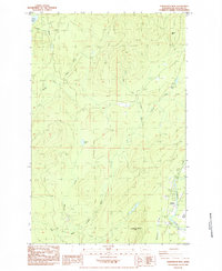
1984 Map of Gunderson Mtn
USGS Topo · Published 1984About this map
Gunderson Mtn and Nelson Hill overlook a complex watershed in the northwest Olympic Peninsula, defined by the convergence of the Middle Fork Dickey River and the East Fork Dickey River. The terrain is marked by numerous industrial Borrow Pit excavations and an extensive network of old railroad grades, signaling the region's history with timber and resource extraction. Evidence of earlier occupation is found at Dickey Camp (Site), located near the shore of Dickey Lake. To the southeast, the landscape transitions into the broader Soleduck Valley, where Maxfield Prairie sits alongside the Soleduck River. This 1984 survey captures the area as it transitioned from early twentieth-century logging toward modern recreational use, indicated by the Boat Ramp near the highway.
Find a feature on this map
26 named features on this map. Tap any name to fly to it.
Don’t see what you’re looking for? This feature index may not catch every label — zoom into the map to look around manually.
Map Details
Editions of this 1984 Gunderson Mtn Map
This is the sole edition of this map. No revisions or reprints were ever made.
Other maps of this area

1935 · Ozette Lake
USGS Topo · 1:62,500

1935 · Lake Pleasant
USGS Topo · 1:62,500

1939 · Forks
USGS Topo · 1:62,500

1942 · Ozette Lake
USGS Topo · 1:62,500

1942 · Lake Pleasant
USGS Topo · 1:62,500

1943 · Copalis Beach
USGS Topo · 1:250,000

1951 · Copalis Beach
USGS Topo · 1:250,000

1953 · Cape Flattery
USGS Topo · 1:250,000

1956 · La Push
USGS Topo · 1:62,500

1956 · Ozette Lake
USGS Topo · 1:62,500