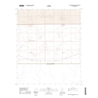
2023 Map of Guzmans Lookout Mountain
USGS Topo · Published 2023About this map
Guzmans Lookout Mountain dominates the center of this southern New Mexico landscape, situated within the expansive Organ Mountains-Desert Peaks National Monument. The terrain is defined by the volcanic features of the West Potrillo Mountains, characterized by numerous cinder cones and desert flats. This modern topographic study illustrates the proximity of these protected lands to the international border, where the southern boundary of the map aligns with the United States of America Estados Unidos Mexicanos line. Transportation through this arid region is limited to remote routes such as Co Rd A002 and A003 Co Rd, which skirt the bases of the volcanic peaks. The map provides a detailed view of the Public Land Survey System township and range divisions, including t29s r4w and t28s r3w, which organize this largely undeveloped desert expanse.
Find a feature on this map
10 named features on this map. Tap any name to fly to it.
Don’t see what you’re looking for? This feature index may not catch every label — zoom into the map to look around manually.
Map Details
Editions of this 2023 Guzmans Lookout Mountain Map
This is the sole edition of this map. No revisions or reprints were ever made.
Other maps of this area

1917 · Camel Mountain
USGS Topo · 1:62,500

1917 · Mt. Riley
USGS Topo · 1:62,500

1918 · Mt. Riley
USGS Topo · 1:62,500

1929 · Mt. Riley
USGS Topo · 1:62,500

1951 · Mt. Riley
USGS Topo · 1:62,500

1953 · El Paso
USGS Topo · 1:250,000

1959 · El Paso
USGS Topo · 1:250,000

1964 · El Paso
USGS Topo · 1:250,000

1965 · El Paso
USGS Topo · 1:250,000
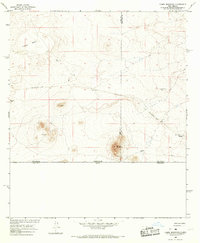
1965 · Camel Mountain
USGS Topo · 1:24,000