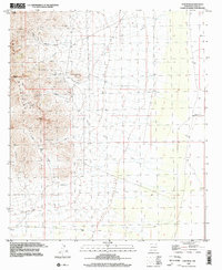
1996 Map of Gym Peak
USGS Topo · Published 2002About this map
Florida Mountains dominate this high-desert landscape in Luna County, revealing a history of extractive industry concentrated along the rugged ridgelines. Numerous excavations including the Krakauer Mine, San Tex Mine, and Mahoney Mines are clustered around steep elevation changes, while the Silver Cave Mine sits near the head of Victorio Canyon. These mining sites, alongside several unnamed Prospect labels, indicate a legacy of mineral exploration that defined the local economy through the mid-20th century.
Find a feature on this map
26 named features on this map. Tap any name to fly to it.
Don’t see what you’re looking for? This feature index may not catch every label — zoom into the map to look around manually.
Map Details
Editions of this 1996 Gym Peak Map
This is the sole edition of this map. No revisions or reprints were ever made.
Other maps of this area

1899 · Deming
USGS Topo · 1:125,000

1915 · Deming
USGS Topo · 1:125,000

1917 · Camel Mountain
USGS Topo · 1:62,500

1917 · Columbus
USGS Topo · 1:62,500

1918 · Columbus
USGS Topo · 1:62,500

1920 · Columbus
USGS Topo · 1:62,500

1953 · El Paso
USGS Topo · 1:250,000

1955 · Las Cruces
USGS Topo · 1:250,000

1958 · Las Cruces
USGS Topo · 1:250,000

1959 · El Paso
USGS Topo · 1:250,000