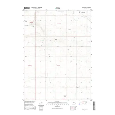
2015 Map of Habig Spring
USGS Topo · Published 2015About this map
Harmony Heights sits on the northwestern edge of this landscape, overlooking a series of dramatic topographical features in Goshen County. The terrain is defined by its water sources and erosional markers, including the namesake Habig Spring and the Sandercock Spring to the south. Significant geological landmarks like Whitehorse Butte, Twin Buttes, and Chalk Hill rise from the plains, while the expanse of London Flats and the South Rim provide distinct markers for local navigation. The map's surveyed roads follow a rigid grid system through the township and range lines, intersecting natural drainage paths such as Habig Draw, Sheep Wash, and Sand Draw. This 2015 survey illustrates how modern ranching and rural access routes like Lingle Veteran Rd and Duncan Cut Across have integrated with the natural landforms of the Wyoming prairie.
Find a feature on this map
34 named features on this map. Tap any name to fly to it.
Don’t see what you’re looking for? This feature index may not catch every label — zoom into the map to look around manually.
Map Details
Editions of this 2015 Habig Spring Map
This is the sole edition of this map. No revisions or reprints were ever made.
Other maps of this area

1896 · Patrick
USGS Topo · 1:125,000

1896 · Hartville
USGS Topo · 1:125,000

1899 · Goshen Hole
USGS Topo · 1:125,000

1901 · Hartville
USGS Topo · 1:125,000

1950 · Rockeagle
USGS Topo · 1:24,000

1950 · Fort Laramie
USGS Topo · 1:24,000

1952 · Fort Laramie
USGS Topo · 1:24,000

1954 · Torrington
USGS Topo · 1:250,000

1954 · Cheyenne
USGS Topo · 1:250,000

1958 · Cheyenne
USGS Topo · 1:250,000