
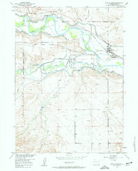
1950 Map of Fort Laramie
USGS Topo · Published 1963About this map
Fort Laramie National Monument stands at the confluence of the North Platte River and the Laramie River, marking a site of immense significance in Western history. This 1950 field check captures the area's transition into the mid-century, where the former grounds of the Fort Laramie Military Reservation (Abandoned) meet a complex modern irrigation network. The landscape is defined by the Fort Laramie Canal, Interstate Canal, and various water-control structures like siphons and sluice gates, reflecting the vital role of water management in the Wyoming plains. To the north, the Chicago Burlington and Quincy railroad tracks parallel the river, connecting the settlement of Fort Laramie to the broader regional economy. The inclusion of the local Cem and family-named watercourses like Deer Creek and Little Deer Creek provides essential landmarks for genealogical research in Goshen County.
Find a feature on this map
20 named features on this map. Tap any name to fly to it.
Don’t see what you’re looking for? This feature index may not catch every label — zoom into the map to look around manually.
Map Details
Editions of this 1950 Fort Laramie Map
3 editions found
Other maps of this area

1896 · Patrick
USGS Topo · 1:125,000

1896 · Hartville
USGS Topo · 1:125,000

1901 · Hartville
USGS Topo · 1:125,000

1950 · Rockeagle
USGS Topo · 1:24,000

1950 · Guernsey
USGS Topo · 1:24,000

1950 · Casebier Hill
USGS Topo · 1:24,000

1950 · Register Cliff
USGS Topo · 1:24,000

1951 · Eagles Nest
USGS Topo · 1:24,000

1952 · Register Cliff
USGS Topo · 1:24,000

1952 · Fort Laramie
USGS Topo · 1:24,000