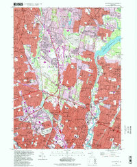
1997 Map of Hackensack
USGS Topo · Published 1998About this map
Hackensack and its neighboring boroughs appear as a dense network of residential streets and arterial highways in this late-twentieth-century study of Bergen County. The landscape is defined by the winding courses of the Saddle River and the Hackensack River, the latter feeding into the expansive Oradell Reservoir. This era shows the mature development of the suburban corridor, where high-capacity routes like the Garden State Parkway and New Jersey Turnpike intersect established local communities.
Find a feature on this map
155 named features on this map. Tap any name to fly to it.
Don’t see what you’re looking for? This feature index may not catch every label — zoom into the map to look around manually.
Map Details
Editions of this 1997 Hackensack Map
This is the sole edition of this map. No revisions or reprints were ever made.
Other maps of this area

1888 · Paterson
USGS Topo · 1:62,500

1891 · Ramapo
USGS Topo · 1:62,500

1891 · Harlem
USGS Topo · 1:62,500

1892 · Paterson
USGS Topo · 1:62,500

1892 · Tarrytown
USGS Topo · 1:62,500

1893 · Tarrytown
USGS Topo · 1:62,500

1893 · Ramapo
USGS Topo · 1:62,500

1897 · Harlem
USGS Topo · 1:62,500

1898 · Harlem
USGS Topo · 1:62,500

1898 · Paterson
USGS Topo · 1:62,500