
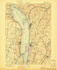
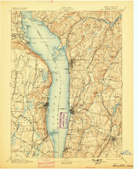
1893 Map of Tarrytown
USGS Topo · Published 1893About this map
Hudson River commerce and industrial growth define the landscape in this late nineteenth-century survey, where the river widens into the Tappan Sea and Haverstraw Bay. The map highlights a critical era of New York infrastructure, documenting both the Croton Aqueduct and the New Croton Aqueduct as they snake south toward the city. Along the eastern shore, the State Prison at Ossining and the bustling riverfronts of Tarrytown and Dobbs Ferry contrast with the prominent ridges of Hook Mt and Verdrietiege Hook on the western bank. Transit is dominated by a dense network of competing lines, including the West Shore Railroad and the New York Central and Hudson River Railroad. Local history is preserved through riverside docks like Waldberg Landing and Snedens Landing, while the inland areas of Orangetown and Mt Pleasant show the early footprints of suburban development around established villages like Nyack and Pleasantville.
Find a feature on this map
128 named features on this map. Tap any name to fly to it.
Don’t see what you’re looking for? This feature index may not catch every label — zoom into the map to look around manually.
Map Details
Editions of this 1893 Tarrytown Map
3 editions found
Other maps of this area

1888 · Paterson
USGS Topo · 1:62,500

1891 · Ramapo
USGS Topo · 1:62,500

1891 · Harlem
USGS Topo · 1:62,500

1892 · Stamford
USGS Topo · 1:62,500

1892 · West Point
USGS Topo · 1:62,500

1892 · Carmel
USGS Topo · 1:62,500

1892 · Paterson
USGS Topo · 1:62,500

1892 · Tarrytown
USGS Topo · 1:62,500

1893 · Carmel
USGS Topo · 1:62,500

1893 · Stamford
USGS Topo · 1:62,500