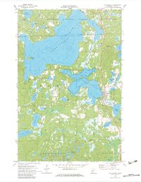
1970 Map of Hackensack
USGS Topo · Published 1983About this map
The glacial waters of Tenmile Lake and Birch Lake dominate this survey of central Cass County, as it appeared in the early 1970s. The village of Hackensack serves as the focal point, situated along the Burlington Northern railroad line and the winding banks of the Boy River. This era shows a landscape defined by state and national forest management, with boundaries for the Chippewa National Forest and Foot Hills State Forest carving through the wooded terrain.
Find a feature on this map
42 named features on this map. Tap any name to fly to it.
Don’t see what you’re looking for? This feature index may not catch every label — zoom into the map to look around manually.
Map Details
Editions of this 1970 Hackensack Map
2 editions found
Other maps of this area

1953 · Brainerd
USGS Topo · 1:250,000

1954 · Bemidji
USGS Topo · 1:250,000

1957 · Brainerd
USGS Topo · 1:250,000

1957 · Bemidji
USGS Topo · 1:250,000

1958 · Bemidji
USGS Topo · 1:250,000

1958 · Brainerd
USGS Topo · 1:250,000

1965 · Brainerd
USGS Topo · 1:250,000

1970 · Backus
USGS Topo · 1:24,000

1970 · Hackensack
USGS Topo · 1:24,000
1970 · Mildred
USGS Topo · 1:24,000