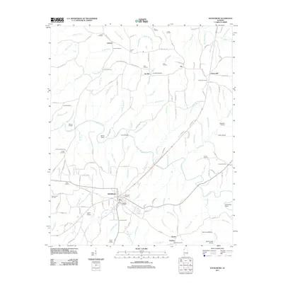
2011 Map of Hackleburg
USGS Topo · Published 2011About this map
Hackleburg serves as the central hub of this northern Alabama landscape, situated along the corridor of Bear Creek and its many tributaries. The settlement pattern is defined by a dense concentration of family and community burial grounds, including Lawler Cemetery, Cleveland Cemetery, and the Cochran Family Cemetery, which provide essential touchstones for genealogical research. Water power and river crossings once shaped local industry and travel, evidenced by the presence of Nix Mill, the Nix Mill Pond Dam, and historical landmarks like Military Bridge.
Find a feature on this map
148 named features on this map. Tap any name to fly to it.
Don’t see what you’re looking for? This feature index may not catch every label — zoom into the map to look around manually.
Map Details
Editions of this 2011 Hackleburg Map
This is the sole edition of this map. No revisions or reprints were ever made.
Other maps of this area

1936 · Hodges
USGS Topo · 1:24,000

1936 · Isbell
USGS Topo · 1:24,000

1936 · Phil Campbell
USGS Topo · 1:24,000

1936 · South Of Hackleburg
USGS Topo · 1:24,000

1936 · Hackleburg
USGS Topo · 1:24,000

1936 · Spruce Pine
USGS Topo · 1:24,000

1936 · Goddard
USGS Topo · 1:24,000

1936 · Guinn Cross Roads
USGS Topo · 1:24,000

1945 · Spruce Pine
USGS Topo · 1:24,000
1945 · Isbell
USGS Topo · 1:24,000