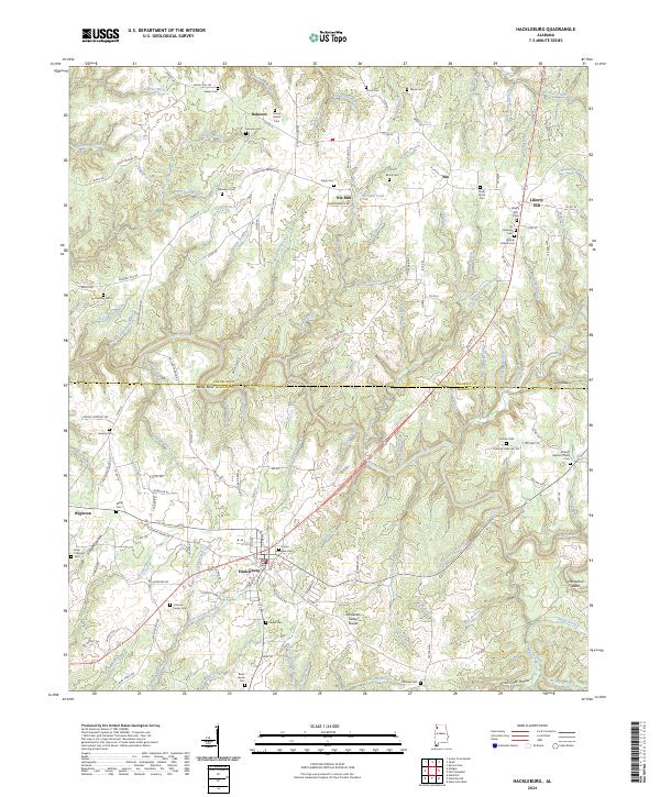
2024 Map of Hackleburg
USGS Topo · Published 2024About this map
Hackleburg serves as the primary hub in this portion of Northwest Alabama, situated where the Tennessee Valley Divide shapes the local watershed. The landscape is defined by a dense network of branches and creeks, including Bear Creek and Little Bear Creek, which carve through terrain marked by landmarks like Graves Hill and Horseshoe Bend. This survey documents a region deeply rooted in its local geography, with numerous small family and community burial grounds such as James Lawler Cem, Cochran Family Cem, and Burnt House Cem scattered across the countryside.
Find a feature on this map
171 named features on this map. Tap any name to fly to it.
Don’t see what you’re looking for? This feature index may not catch every label — zoom into the map to look around manually.
Map Details
Editions of this 2024 Hackleburg Map
This is the sole edition of this map. No revisions or reprints were ever made.
Other maps of this area

1936 · Hodges
USGS Topo · 1:24,000

1936 · Isbell
USGS Topo · 1:24,000

1936 · Phil Campbell
USGS Topo · 1:24,000

1936 · South Of Hackleburg
USGS Topo · 1:24,000

1936 · Hackleburg
USGS Topo · 1:24,000

1936 · Spruce Pine
USGS Topo · 1:24,000

1936 · Goddard
USGS Topo · 1:24,000

1936 · Guinn Cross Roads
USGS Topo · 1:24,000

1945 · Spruce Pine
USGS Topo · 1:24,000
1945 · Isbell
USGS Topo · 1:24,000