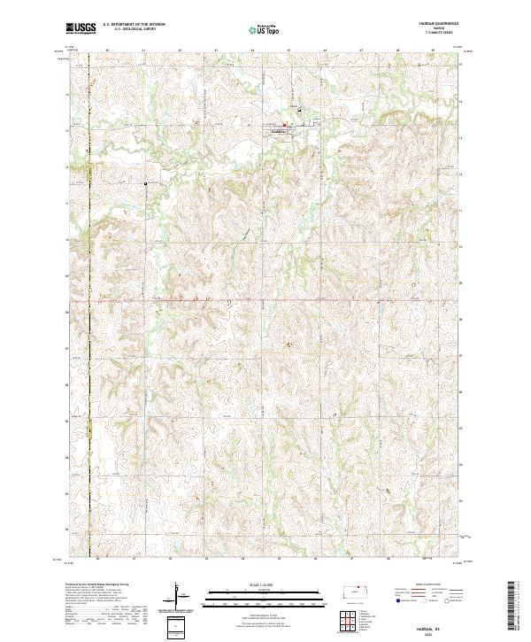
2022 Map of Haddam
USGS Topo · Published 2022About this map
Haddam serves as the central hub for this portion of the northern Kansas plains, situated at the junction of Kansas St and Austin St. The landscape is defined by the complex drainage of the Mill Cr system, including its north and south forks, which carve through the terrain to create landforms like Hay Valley. Significant for family history researchers, the map identifies local burial sites such as Haddam Cem just north of the town limits and the more isolated Oliver Cem to the southwest. The gridded road network, consisting of thoroughfares like Concord Rd and Deer Rd, illustrates the organized agricultural partitioning of Washington County near the Republic County line. Numerous small watercourses, including Mulberry Cr and Parsons Cr, intersect these roads, indicating the local topography's influence on regional travel and land use.
Find a feature on this map
51 named features on this map. Tap any name to fly to it.
Don’t see what you’re looking for? This feature index may not catch every label — zoom into the map to look around manually.
Map Details
Editions of this 2022 Haddam Map
This is the sole edition of this map. No revisions or reprints were ever made.
Other maps of this area

1893 · Washington
USGS Topo · 1:125,000

1955 · Manhattan
USGS Topo · 1:250,000

1956 · Manhattan
USGS Topo · 1:250,000

1957 · Manhattan
USGS Topo · 1:250,000

1965 · Brantford
USGS Topo · 1:24,000

1965 · Agenda
USGS Topo · 1:24,000
1966 · Washington NW
USGS Topo · 1:24,000

1966 · Morrowville
USGS Topo · 1:24,000
1966 · Narka
USGS Topo · 1:24,000
1966 · Haddam
USGS Topo · 1:24,000