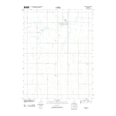
2009 Map of Haddam
USGS Topo · Published 2009About this map
Haddam serves as the primary hub in this portion of Washington County, situated along the upper reaches of Mill Creek. The town's grid is anchored by Main St and Arlington St, with the Haddam Cemetery located just to the north. The surrounding agricultural landscape is defined by the drainage of several waterways, including the North Fork Mill Creek and South Fork Mill Creek, which converge as they flow through Hay Valley.
Find a feature on this map
32 named features on this map. Tap any name to fly to it.
Don’t see what you’re looking for? This feature index may not catch every label — zoom into the map to look around manually.
Map Details
Editions of this 2009 Haddam Map
This is the sole edition of this map. No revisions or reprints were ever made.
Other maps of this area

1893 · Washington
USGS Topo · 1:125,000

1955 · Manhattan
USGS Topo · 1:250,000

1956 · Manhattan
USGS Topo · 1:250,000

1957 · Manhattan
USGS Topo · 1:250,000

1965 · Brantford
USGS Topo · 1:24,000

1965 · Agenda
USGS Topo · 1:24,000
1966 · Washington NW
USGS Topo · 1:24,000

1966 · Morrowville
USGS Topo · 1:24,000
1966 · Narka
USGS Topo · 1:24,000
1966 · Haddam
USGS Topo · 1:24,000