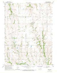
1966 Map of Narka
USGS Topo · Published 1967About this map
The agrarian landscape of northern Republic County is defined here by the small community of Narka, situated at the intersection of the Chicago Rock Island and Pacific railroad and a grid of rural section roads. This 1960s survey illustrates a classic Kansas township structure, with the town serving as a central hub for Albion and Farmington townships. The topography is shaped by several drainages, including the winding Rose Creek in the west and the North Fork Mill Creek along the southern border. For genealogists, the map is particularly valuable for its documentation of local burial grounds, including the National Cem, Maple Grove Cem, Ida Cem, and Hubbell Cem, which are scattered throughout the agricultural tracts. A lone Quarry in the eastern hills suggests localized industry amidst the dominant wheat and grain fields of the era.
Find a feature on this map
13 named features on this map. Tap any name to fly to it.
Don’t see what you’re looking for? This feature index may not catch every label — zoom into the map to look around manually.
Map Details
Editions of this 1966 Narka Map
This is the sole edition of this map. No revisions or reprints were ever made.
Other maps of this area

1892 · Concordia
USGS Topo · 1:125,000

1893 · Washington
USGS Topo · 1:125,000

1898 · Hebron
USGS Topo · 1:125,000

1955 · Manhattan
USGS Topo · 1:250,000

1955 · Lincoln
USGS Topo · 1:250,000

1956 · Manhattan
USGS Topo · 1:250,000

1957 · Manhattan
USGS Topo · 1:250,000

1957 · Lincoln
USGS Topo · 1:250,000

1958 · Lincoln
USGS Topo · 1:250,000

1960 · Chester
USGS Topo · 1:24,000