
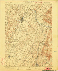
1942 Map of Hagerstown
USGS Topo · Published 1942About this map
The Potomac River corridor and its industrial lifeblood define this wartime survey, where the Chesapeake and Ohio Canal parallels the river's winding path through the borderlands of Maryland, Pennsylvania, and West Virginia. This region is a major transportation hub, anchored by Hagerstown and Chambersburg, with a dense network of railroads including the Pennsylvania RR and Western Maryland RR. The presence of the Cumbo Freight Yard and Williamsport Sta underscores the area's strategic logistical importance during the early 1940s.
Find a feature on this map
309 named features on this map. Tap any name to fly to it.
Don’t see what you’re looking for? This feature index may not catch every label — zoom into the map to look around manually.
Map Details
Editions of this 1942 Hagerstown Map
This is the sole edition of this map. No revisions or reprints were ever made.
Other maps of this area

1884 · Harpers Ferry
USGS Topo · 1:125,000

1891 · Harpers Ferry
USGS Topo · 1:125,000

1893 · Frederick
USGS Topo · 1:125,000

1893 · Harpers Ferry
USGS Topo · 1:125,000

1894 · Frederick
USGS Topo · 1:125,000

1894 · Winchester
USGS Topo · 1:125,000

1899 · Hancock
USGS Topo · 1:62,500

1900 · Mercersburg
USGS Topo · 1:62,500

1901 · Hancock
USGS Topo · 1:62,500
1902 · Chambersburg
USGS Topo · 1:62,500