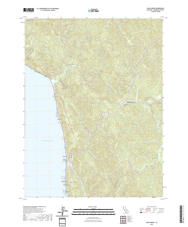
2022 Map of Hales Grove
USGS Topo · Published 2022About this map
Cottaneva Valley and the steep coastal ridges of Mendocino County define this modern topographic landscape, where the rugged shoreline meets the Pacific Ocean. The geography reflects a history of coastal access and timber harvesting, indicated by labels like Timber Haul Rd and the Lost Coast Trl winding along the cliffs near Timber Point. Inland, small named settlements like Hales Grove and Shady Dell sit tucked into the drainages of Usal Creek and its many tributaries. The map details a complex network of gulches, from Slaughterhouse Gulch to Waterfall Gulch, alongside prominent maritime landmarks such as Usal Rock and Shoreline Rock. Researchers can trace the narrow coastal roads and trails that connect these isolated points, providing a contemporary view of this sparsely populated section of the California coast.
Find a feature on this map
52 named features on this map. Tap any name to fly to it.
Don’t see what you’re looking for? This feature index may not catch every label — zoom into the map to look around manually.
Map Details
Editions of this 2022 Hales Grove Map
This is the sole edition of this map. No revisions or reprints were ever made.
Other maps of this area

1920 · Cummings
USGS Topo · 1:62,500

1921 · Westport
USGS Topo · 1:62,500

1921 · Branscomb
USGS Topo · 1:62,500

1950 · Piercy
USGS Topo · 1:62,500

1950 · Cape Vizcaino
USGS Topo · 1:62,500

1951 · Cape Vizcaino
USGS Topo · 1:62,500

1951 · Branscomb
USGS Topo · 1:62,500

1952 · Leggett
USGS Topo · 1:62,500

1957 · Ukiah
USGS Topo · 1:250,000

1960 · Ukiah
USGS Topo · 1:250,000